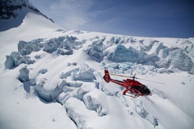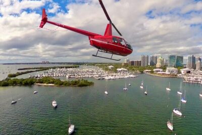
That moment the helicopter lifts off Duluth—wow. I love the Lake Superior views that you simply can’t replicate from land, and I love that you get guided commentary through headsets as you fly.
This tour also works as a tight “greatest hits” loop. You’ll get a high, clear angle on Duluth’s biggest landmarks, plus the river, harbor, and bridges that shape the city’s vibe.
One thing to consider: this experience depends on good weather, so if clouds or wind ruin the flight conditions, you’ll need to reschedule.
In This Review
- Key things to know before you go
- Why Duluth from the Air Feels Like a Shortcut
- Your Flight Time: 40 to 45 Minutes That Packs a Lot
- Stop 1: Jay Cooke State Park and Thompson Reservoir
- Stop 2: The St Louis River Corridor Into Duluth
- Stop 3: Port of Duluth Docks and Downtown from Above
- Stop 4: Duluth’s Aerial Lift Bridge
- Stop 5: Park Point from the Sky
- Stop 6: A Historic Mansion Aerial View
- Stop 7: Hartley Nature Center on the Way Back
- Stop 8: Airport Area and Campus Views
- What’s Included—and Why Those Small Things Matter
- Price and Value: Is $430.92 Worth It?
- Where You Meet and How to Plan Your Day
- Weather Rules: The Real Governor of Your Flight
- Who This Tour Suits Best
- Weight Limits and Practical Comfort
- Should You Book the 60-Mile Helicopter Tour?
- FAQ
- How long is the 60-Mile Ultimate Helicopter Tour?
- Where does the tour start?
- Is hotel pickup included?
- What’s included in the price?
- What if the weather is too poor for flying?
- Is this a private tour?
- What are the weight limits?
- Can I cancel and get a refund?
Key things to know before you go
- Private group experience: only your group flies, so the flight feels more personal.
- A pilot who talks (Geo, especially): one pilot named Geo is praised for being fun and informative.
- You see multiple “systems” at once: river, port, bridge, neighborhoods, and nature—mixed into one route.
- A lift bridge, a point, and waterfronts: the itinerary hits Duluth’s most recognizable shapes from above.
- Weight limits are real: 300 lbs per passenger, with a combined limit of 575 lbs for all passengers.
Why Duluth from the Air Feels Like a Shortcut
Duluth is one of those places where geography does the talking. From the ground, you can appreciate Lake Superior and the North Shore. From the air, the scale finally clicks. You’re not just looking at a lake—you’re watching the shore curve, the coastline change, and the city sit in a tight relationship with water, hills, and roads.
I also like how the tour is designed to keep your attention. In 40 to 45 minutes, you’re not stuck staring at the same kind of view. You move from parks and reservoirs to the river corridor to the port docks, then up to bridges and back through nature and campus areas.
You can also read our reviews of more tours and experiences in Duluth.
Your Flight Time: 40 to 45 Minutes That Packs a Lot
The tour runs about 40 to 45 minutes. That matters because helicopter time is precious, and this route seems built to maximize variety without stretching too long.
You also should plan your expectations around pace. This is not a slow scenic drift with long stops. It’s a focused loop where you’re constantly getting new angles—ideal if you like seeing “how it all connects” instead of just visiting one single viewpoint.
Stop 1: Jay Cooke State Park and Thompson Reservoir
The tour kicks off with an aerial look at Jay Cooke State Park and the Thompson Reservoir. From above, this kind of terrain can feel like a map you can fly around. Forest edges, water shapes, and the way the park sits relative to the broader North Shore region are much easier to understand from a birds-eye perspective.
What I like about this start is that it shifts your brain from city mode to nature mode quickly. You’ll get the feeling that Duluth isn’t just a port city—it’s surrounded by places that look dramatic from every direction.
If you’re the type who enjoys photos, this is an early opportunity to grab that “wow” shot while visibility is fresh and you haven’t built up too much motion in your camera arm.
Stop 2: The St Louis River Corridor Into Duluth
Next up is a flyover of the St Louis River as it makes its way toward Duluth. Rivers can look “straight and simple” from the road. From the air, you start noticing bends, how the water threads between landforms, and how the river system sets up the city’s industrial and residential zones.
This stop is valuable because it gives you context for the rest of the route. When you later see the port area and docks, the river makes more sense—because you’ve already watched it feed into Duluth’s waterways.
Stop 3: Port of Duluth Docks and Downtown from Above
Then you get to the port: a flyover of the docks at the Port of Duluth, plus downtown Duluth. This is where Duluth’s working waterfront identity comes through. You can pick out the structure of the harbor, the line of the docks, and the way downtown sits close to the water.
I like this mix of commercial and civic view. Many aerial experiences focus on pure nature or pure city skylines. Here, you get both: a port that explains the city’s economy and a downtown view that shows how closely everything is tied to Lake Superior.
Practical note: if you’re planning photos, this is a strong segment to try for crisp shots, since ports can have lots of visual edges and geometry.
Stop 4: Duluth’s Aerial Lift Bridge
One of the itinerary’s star moments is the aerial lift bridge. Seeing it from above is the difference between recognizing a landmark and truly understanding how it functions in the bigger scene. You’ll get a clean read on its position relative to the harbor and surrounding routes.
This stop is a great reminder that Duluth’s engineering and geography aren’t separate stories. They’re intertwined. From the helicopter, you can track how the bridge sits in the web of roads and water access that shapes the area.
Stop 5: Park Point from the Sky
After the bridge, you fly by Park Point. Park Point is the kind of place that can feel like “just part of the shoreline” until you see it from above. Then you start noticing its shape and how it relates to the water on either side.
I like Park Point here because it provides a softer, more shoreline-focused view after the busy visuals of the port and downtown. It breaks the flight into a rhythm: city systems, bridge moment, then a calmer natural segment.
If you want variety in your photos—water, buildings, structures, and then calmer shoreline this is a good place to look.
Stop 6: A Historic Mansion Aerial View
You’ll also get a view of a historic mansion from the air. I don’t want to oversell what you’ll see—helicopter views of any single building are usually quick and angle-dependent—but from above you can often pick up the property scale and the way it sits into the neighborhood.
This stop adds texture to the flight. You’re not only seeing the city’s infrastructure. You’re also seeing hints of how Duluth’s wealth and architecture played out in the terrain and neighborhoods.
Stop 7: Hartley Nature Center on the Way Back
On the return, the route includes a flyby of the Hartley Nature Center as you head back toward Duluth. Nature center aerial views can be surprisingly helpful because you get both the “green space” and the context—how it fits next to trails, roads, and the wider city pattern.
I like this part for a simple reason: it finishes your tour with a calmer visual note. After port and downtown, it’s nice to let your eyes rest on natural shapes.
Stop 8: Airport Area and Campus Views
Finally, you get a view of campus from the air as you head back to Duluth Intl Airport. Even if you’re not visiting the campus on foot, aerial context helps. You can understand where campus sits relative to the rest of Duluth, and that makes the next time you drive around feel a bit more “legible.”
Because the flight ends back at the meeting point, this final segment feels like a wrap-up: you’re not adding a new destination. You’re returning with a mental map.
What’s Included—and Why Those Small Things Matter
This ticket includes airport/departure tax, a professional guide, and headsets. Those sound like minor line items, but they matter in a helicopter setting.
- Headsets keep the guide’s narration clear and let you hear directions without straining.
- A professional guide turns random sights into a connected route. You’re not just looking; you’re learning what you’re looking at.
- Tax included means you’re not doing math at checkout when you’re already thinking about the flight.
Also, the experience is private. That’s a big deal for comfort and pacing. If your group has questions, you’re not competing with strangers for the guide’s attention.
Price and Value: Is $430.92 Worth It?
At $430.92 per person, this isn’t a budget activity. So the real question isn’t whether it’s pricey—it’s whether it’s the right “once-in-a-trip” experience for you.
Here’s how I’d judge value:
- If you want a fast way to understand Duluth’s geography, this tour gives you a high-level map in under an hour.
- If you’re excited by port, bridge engineering, river systems, and North Shore terrain, this route hits multiple interests in one session.
- If you’re traveling with a small group and can share the experience, the private nature helps justify the cost.
If your goal is only one viewpoint and you’re happy to do ground-level sightseeing, you might find alternatives cheaper. But if you want the wow factor tied to real context—Lake Superior plus the city’s key features—this is priced like an experience built for that specific payoff.
Where You Meet and How to Plan Your Day
You meet at 4525 Airport Approach Rd, Duluth, MN 55811, USA, and the tour ends back at that same meeting point.
Hotel pickup and drop-off are not included. So you’ll want to factor in your own rideshare or car logistics. That’s not a dealbreaker, but it does affect how smooth your schedule feels.
As for timing, confirmation is received at booking, and the company can operate in all seasons. Dress for the weather you’ll actually face on the day, not the weather you hope for.
Weather Rules: The Real Governor of Your Flight
This experience requires good weather. Helicopter flying is sensitive to cloud cover, wind, and visibility. If conditions aren’t right, you’ll be offered a different date or a full refund.
My practical advice: treat your flight date like a priority slot on your trip. If you can build in flexibility—by not packing your schedule too tightly on that day—you’ll be less stressed if you get rerouted.
Who This Tour Suits Best
This is a strong match if you:
- Want a quick, high-impact way to see Duluth and Lake Superior from above.
- Enjoy technical landmarks like the aerial lift bridge and port areas.
- Like nature and city in the same outing.
- Want a private experience with a guide and clear audio through headsets.
It’s also a good choice for travelers who are short on time but still want a “big memory.” In under an hour, you get multiple segments that would take a full day to replicate with driving and stopping.
Weight Limits and Practical Comfort
There’s a total passenger weight limit of 300 lbs per passenger. There’s also a combined limit of 575 lbs for all passengers together.
If your group is close to those numbers, confirm before booking so you don’t end up with a last-minute issue. This is one of those tours where the fine print affects reality.
Should You Book the 60-Mile Helicopter Tour?
If your trip includes Duluth and Lake Superior and you can handle the cost, I think this tour is worth booking—especially because it mixes nature, river, port, and engineering landmarks into one loop.
I’d skip it only if you want a cheap activity, dislike weather-dependent plans, or you’d rather spend your time on the ground where you can linger. But if you’re craving that aerial “map in motion” feeling and you want the best angles quickly, this is the kind of flight that pays you back with instant perspective.
FAQ
How long is the 60-Mile Ultimate Helicopter Tour?
It lasts about 40 to 45 minutes.
Where does the tour start?
The meeting point is 4525 Airport Approach Rd, Duluth, MN 55811, USA.
Is hotel pickup included?
No. Hotel pickup and drop-off are not included.
What’s included in the price?
The ticket includes airport/departure tax, a professional guide, and headsets.
What if the weather is too poor for flying?
The experience requires good weather. If it’s canceled due to poor weather, you’ll be offered a different date or a full refund.
Is this a private tour?
Yes. This is private, and only your group participates.
What are the weight limits?
The total weight per passenger is 300 lbs. The combined weight of all passengers must not exceed 575 lbs.
Can I cancel and get a refund?
Yes. Free cancellation is available up to 24 hours in advance for a full refund. Cancel less than 24 hours before the start time and the amount paid is not refunded.