REVIEW · WANAKA
Wānaka: Scenic Helicopter Flight Wānaka Max
Book on GetYourGuide →Operated by Wanaka Helicopters · Bookable on GetYourGuide
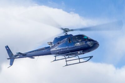
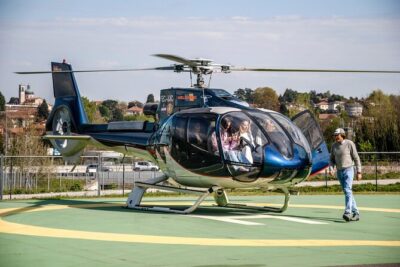
Helicopter landings turn views into stories. In 45 minutes, this Wānaka Max scenic flight stacks in two alpine landings, so you’re not just looking out the window—you’re actually stepping onto high-country spots with huge panorama payoff. You’ll get standout views over the Matukituki River valley plus dramatic mountain scenery across the Wānaka region.
What I like most is how the flight mixes glacier-carved grandeur with quieter details, like the way Mou Waho looks from above (that special lake-within-a-lake effect). I also like that you’re led by a live English guide/pilot, and at least one guest specifically called out a pilot named Travis for pointing out special points during the flight. One thing to consider: the Coromandel Peak – Mt Roy landing is only if available, and like all helicopter plans here, weather or pilot availability can cause a change to your departure time.
In This Review
- Key Highlights (The Stuff Worth Booking For)
- Why the Wānaka Max Flight Feels Bigger Than a Standard Scenic Hop
- Meeting at Wanaka Helicopters and What the Start Means for You
- Matukituki River Valley: The View That Shows the Whole Story
- Alpine Landing #1: Coromandel Peak and Mt Roy When Conditions Allow
- Mou Waho Island: The Lake-Within-a-Lake Effect From Above
- Mt Aspiring National Park: Snow-Capped Peaks and Glacier-Carved Valleys
- Lake Hāwea and Stevensons Arm: The Contrast You Can Actually See
- The Pilot Experience: Why the Commentary Can Matter
- Photos in a Helicopter: How to Set Yourself Up for the Good Shots
- Price and Value: What $298 Really Buys You
- Who Should Book This Flight (and Who Might Think Twice)
- Should You Book the Wānaka Max Helicopter Flight?
- FAQ
- FAQ
- How long is the Wānaka Max helicopter flight?
- Where do I meet for the flight?
- What is included in the Wānaka Max experience?
- What views can I expect during the flight?
- Are meals and drinks included?
- Can the flight be canceled or postponed?
- Is the activity wheelchair accessible?
Key Highlights (The Stuff Worth Booking For)
- Two alpine landings in one flight so you get both flight views and on-the-spot viewpoints
- Coromandel Peak – Mt Roy touch-down if available, including iconic panorama views around 4,000 feet
- Matukituki River valley views from above, with the shape of the valley doing most of the storytelling
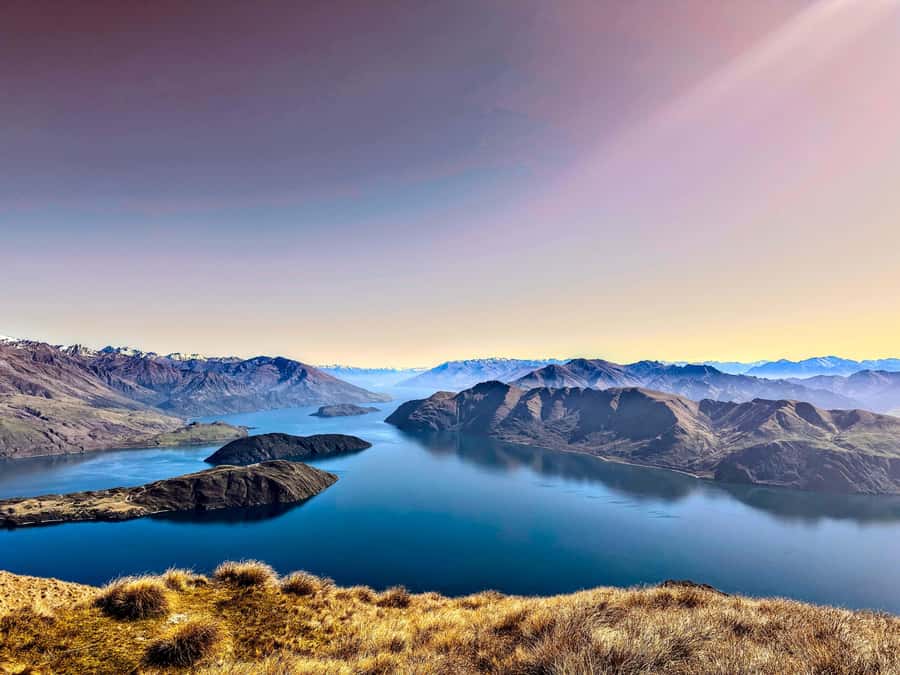
- Mou Waho Island’s lake-within-a-lake look seen from the air in a way you can’t replicate from the road
- Mt Aspiring National Park views of snow-capped peaks and glacier-carved valleys
- Lake Hāwea and Stevensons Arm contrast shown clearly from the sky as you move through the circuit
Why the Wānaka Max Flight Feels Bigger Than a Standard Scenic Hop
Wānaka is already good at scenery. The Wānaka Max version is good at delivery. In a short time window, you’re treated to more variety than you’d expect from a typical scenic flight: river valley geometry, alpine footing via two landings, and then high-mountain views that feel almost unreal.
The big difference for your experience is the combination. A standard aerial tour can be great, but once you’ve seen one ridge and one lake, the repetition starts. Here, you keep getting fresh visual questions to answer: Where does the river cut through the valley? Why does Mou Waho look like it contains a smaller version of itself? How do glacier valleys read from above? That constant change is what makes this feel worth the money, not just a thrill ride.
You can also read our reviews of more tours and experiences in Wanaka.
Meeting at Wanaka Helicopters and What the Start Means for You
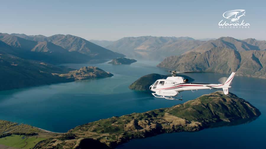
Your flight starts at the Wanaka Helicopters office. That matters more than it sounds, because this isn’t a “wander around and hope” kind of activity. You’ll want to give yourself enough time to check in calmly, especially if you’re pairing this with other Wānaka plans.
Also note the practical stuff: there’s a live English tour guide, and you can skip the ticket line. If you’re traveling with limited time between hikes, scenic drives, or dinner reservations, those small workflow wins add up.
Matukituki River Valley: The View That Shows the Whole Story
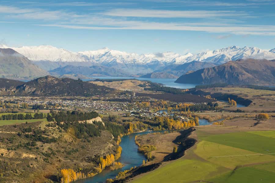
One of the most satisfying parts is the time you spend looking down at the Matukituki River. From the air, river valleys stop being just scenery and start becoming a map of how the region was carved. You can see the way the valley holds the river, where it widens, and how it bends as it threads past steeper terrain.
This is also where the flight can feel especially “Wānaka,” because you get both rugged relief and a lived-in sense of scale—peaks overhead, waterway below, and native bush framing the middle ground. If you’re the kind of person who likes to understand what you’re looking at (not just admire it), this river section does a lot of the explaining.
Alpine Landing #1: Coromandel Peak and Mt Roy When Conditions Allow
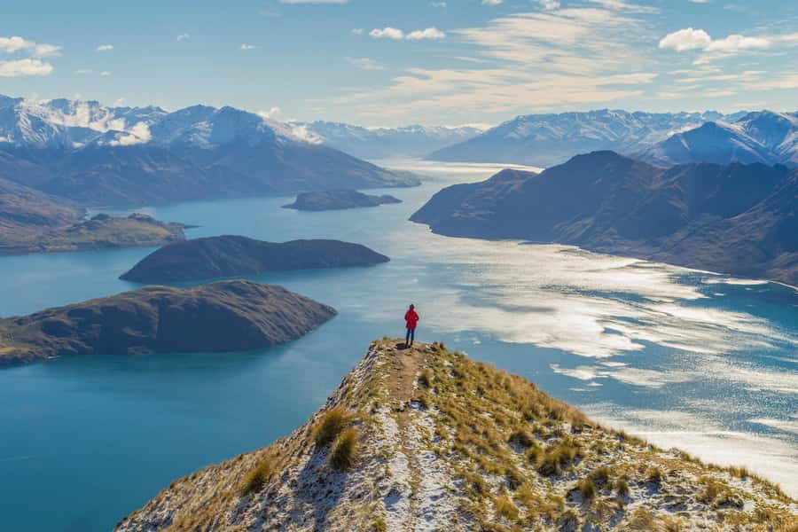
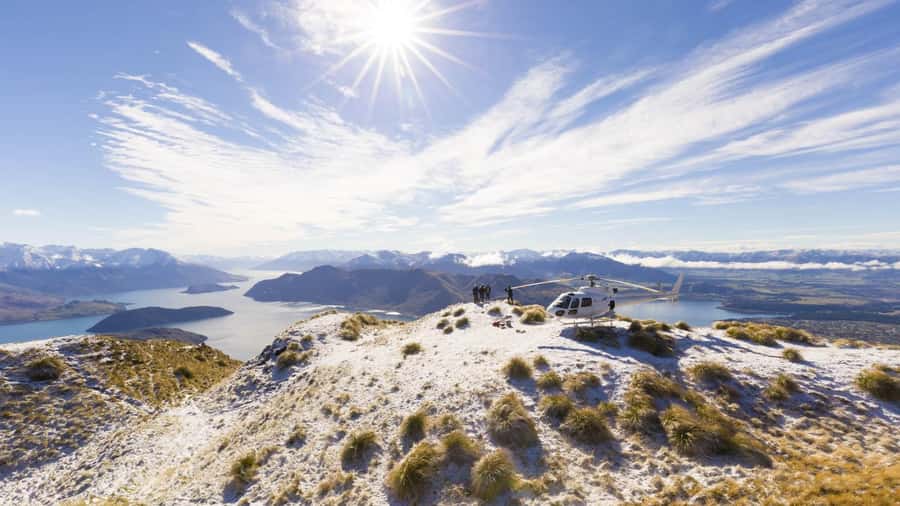
The headliner moment is the potential touch-down at Coromandel Peak – Mt Roy. When it’s available, the flight includes a landing at about 4,000 feet, and that’s a sweet altitude for perspective: high enough to see the bigger layout of Wānaka country, but close enough to recognize features without squinting into the distance.
From that landing, you’re set up for panoramic views of things like:
- Lake Wānaka and the township area
- the wider region stretching outward
The reason this works so well is simple: you’re not stuck in motion. You get a real viewpoint, even if the time is short. And for photos, a landing gives you a stable angle and a chance to frame the scene with your own feet on the ground instead of only through a passing window.
Possible drawback: since the Mt Roy landing is if available, you should go in with flexibility. If conditions don’t allow it, you’ll still have the rest of the flight’s big-ticket sights, but the “step onto the iconic peak” moment might not happen the way you hoped.
Mou Waho Island: The Lake-Within-a-Lake Effect From Above
Then comes the fun surprise: Mou Waho Island and that famous look described as a lake within a lake. The key is that it’s a visual pattern you can’t easily recreate from shore or from road viewpoints, because the effect is all about how water shapes stack and reflect from a top-down perspective.
Also, Mou Waho is a protected Nature Reserve, which makes it feel extra special to see it from above with the kind of respect that comes with limited access. Even if you don’t know the local ecology details, the view communicates something: the island’s water features have a distinct geometry, and the helicopter angle lets you read that geometry instantly.
This is the part of the flight where you’ll likely hear yourself say, “Oh wow, I get it now.” That’s the value of aerial perspective—some places only make full sense from the sky.
Mt Aspiring National Park: Snow-Capped Peaks and Glacier-Carved Valleys
Next you’re in Mt Aspiring National Park, which the experience describes as World Heritage–listed. From your seat, the attraction is the raw mountain drama: snow-capped peaks and ancient glacier-carved valleys.
From ground level, glacier-carved terrain can be hard to “read.” From above, you see channels and contours that look like they were drawn by time itself. You understand why the valleys are shaped the way they are—not just that they look spectacular.
This is also where the flight shifts from “picturesque” to “wow, this is geological.” If you’re traveling with someone who loves hiking and big views, this segment is a strong reason to choose helicopter over a longer day of driving and walking. You get the visual big picture without spending a full day on uneven trails.
Lake Hāwea and Stevensons Arm: The Contrast You Can Actually See
Wānaka region water features can be subtle when you’re on the ground. From above, they turn into a contrast lesson. You’ll take in Lake Hāwea and Stevensons Arm from the air, and you’ll see how the waterways and surrounding terrain change as you move through the circuit.
The experience specifically notes a passage through Stevensons Arm and then a view back over Lake Hāwea, before returning toward Wānaka and the airport.
For you, the benefit is clarity. You’ll come away understanding how these waterways sit relative to the mountains and why the shapes matter. It’s the kind of view that helps you plan future ground time too—like which roadside viewpoint might be best for a short stop, or which direction you should drive for the best light.
The Pilot Experience: Why the Commentary Can Matter
A scenic flight gets better when the pilot isn’t only flying; they’re also guiding your attention. In one guest’s notes, Travis was singled out as both an excellent pilot and a helpful guide who pointed out special points during the flight. That’s exactly what you should look for when choosing a helicopter tour: someone who helps you translate what you’re seeing into something you’ll remember.
In practice, that means:
- you’ll get more out of each visual change
- you’ll be better prepared to take photos right when the scene lines up
- you’ll notice features you might otherwise miss
If you’re the type who likes to ask questions, this is also the moment to do it. A 45-minute flight doesn’t leave much time for chit-chat later—so use the live guidance while you have it.
Photos in a Helicopter: How to Set Yourself Up for the Good Shots
Let’s talk photos, because multiple guests emphasized that the flight is a great way to get strong images. Here’s the practical part: you’ll be dealing with motion, glass, and fast-changing views.
To improve your odds:
- keep your camera/phone ready as you approach major viewpoints (especially around the landing moments)
- focus on framing the bigger shapes first—rivers, lakes, and valley lines read best from the air
- don’t wait until the last second; you’ll want a moment to adjust settings
Also, landings help. A touch-down gives you a steadier composition and a chance to frame wider panoramas without only chasing the moving window view.
If you’re trying to capture the “lake within a lake” effect, be ready early. A scene like that is about timing and angle. When it hits, you’ll want your lens up.
Price and Value: What $298 Really Buys You
At $298 per person for 45 minutes, this isn’t a budget activity. The value question is whether you’re paying for a simple ride or for something more.
You’re paying for:
- two alpine landings, not just one
- iconic viewpoints like Coromandel Peak – Mt Roy when available
- a guided circuit with multiple distinct regions: Matukituki River, Mou Waho, Mt Aspiring, Lake Hāwea, and Stevensons Arm
That makes the cost easier to justify if your time in Wānaka is limited or you want to see the high-mountain side without a full hike day. It’s also a good choice if you’re traveling with someone who finds it hard to commit to long drives or strenuous trails but still wants big-scenery payoff.
On the flip side, if you’re already planning an intense hiking itinerary and you’re trying to keep costs down, you might feel torn. This experience is best when you treat it as the “big view shortcut” that complements your ground time, not as a replacement for it.
Who Should Book This Flight (and Who Might Think Twice)
This fits best if you:
- want maximum variety in a short time
- love geography and mountain form, not only pretty scenery
- want to step onto a peak viewpoint via alpine landings
- are traveling with someone who would enjoy a guided aerial experience
It might not be the best match if:
- you need lots of time on the ground (this is a 45-minute flight)
- you’re traveling with very tight scheduling buffers because weather or pilot availability can affect your exact departure (the flight can be postponed or canceled sometimes)
- you’re expecting meals included (there are no meals or drinks)
Should You Book the Wānaka Max Helicopter Flight?
If your priority is seeing more of Wānaka’s dramatic geography without spending a whole day moving around, I think this is a strong yes. The two alpine landings are the big reason, and the mix of Matukituki River valley, Mou Waho’s lake-within-a-lake, and Mt Aspiring National Park makes the 45 minutes feel full rather than rushed.
If you’re the flexible type—and you’re okay with the possibility that the Mt Roy landing depends on conditions—then this is exactly the kind of ticket that turns your trip into a highlight you’ll still be talking about later.
FAQ
FAQ
How long is the Wānaka Max helicopter flight?
It lasts 45 minutes.
Where do I meet for the flight?
You meet at the Wanaka Helicopters Office.
What is included in the Wānaka Max experience?
It includes two alpine landings and breathtaking views of the Wānaka region, including Coromandel Peak – Mt Roy if available.
What views can I expect during the flight?
You can expect views of the Matukituki River, Mou Waho Island (the lake-within-a-lake effect), Mt Aspiring National Park, and contrasts between Lake Hāwea and Stevensons Arm.
Are meals and drinks included?
No. Meals and drinks are not included.
Can the flight be canceled or postponed?
Yes. The operator may need to cancel or postpone due to weather or pilot availability, and the flight time is confirmed by their team within 24 hours of your booking.
Is the activity wheelchair accessible?
Yes, it is wheelchair accessible.