REVIEW · SEDONA
Mogollon Rim (80+ Mile) – Sedona Helicopter Tour
Book on Viator →Operated by Apex Air Tours · Bookable on Viator
A helicopter ride over Sedona is the closest thing to time travel. This Mogollon Rim loop turns big-name red rock icons and ancient ruin sites into a bird’s-eye photo shoot, with most of the action served straight from the pilot’s route. I especially like the all-forward seating plus noise-reduction headsets with microphones, which keeps the whole experience clear and comfortable. One thing to consider: the flight is weather-dependent and the views move fast, so you’ll want your camera ready before you notice you’re already passing the famous stuff.
You’ll be in the air for about 50 to 52 minutes, but the variety is the point: Sedona’s rock formations, canyon cuts, major bridges, and multiple ruin areas, all strung together like a highlights reel. The tour maxes at 6 travelers, so it feels more personal than the big-crew options. If you’re sensitive to flying, or you show up sick on the day, plan on being turned away because flying is prohibited when you’re sick.
In This Review
- Quick Hits Before You Go
- Why This Mogollon Rim Route Feels Like a Front-Row Seat
- Price and Time: What $712.93 Buys in 50 Minutes
- Before You Fly: Meeting Point, Seats, and Comfort Details
- From the Sedona Airport Overlook to Cathedral Rock
- Bell Rock, Submarine Rock, Snoopy, and the Praying Hands
- Cow Pies, the Eagle, Tea Kettle, and Other Signature Formations
- Oak Creek Canyon, Midgely Bridge, and Brins Mesa Panoramas
- Devil’s Bridge from the Air, Plus Honanki Ruins
- Ruins Through Boynton Canyon and Long Canyon
- The Sycamore Canyon Stop: Quick, Scenic, and Focused
- Cottonwood Airport Views: Tuzigoot, Jerome, Verde River, and Wilderness Country
- Who Should Book This Helicopter Tour (and Who Might Want Another Option)
- Should You Book Apex Air Tours for This 80+ Mile Flight?
- FAQ
- How long is the Sedona Helicopter Tour?
- How much does the tour cost?
- Where does the tour start and end?
- What seats are provided?
- Are noise-reduction headsets provided?
- What group size can I expect?
- What is the weight limit per passenger?
- Is the tour offered in English?
- Can I fly if I’m pregnant?
- What happens if weather is poor?
- Can I cancel for a full refund?
Quick Hits Before You Go
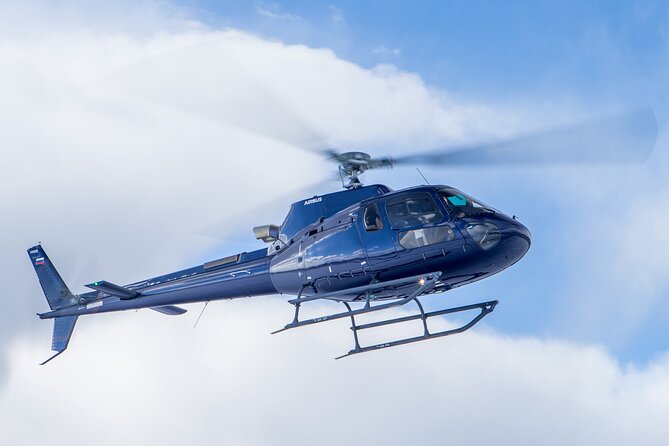
- Forward-facing seats mean you’re pointed at the sights for the whole flight
- Noise-reduction headsets with microphones help you hear the pilot clearly
- Up to 5 people in your group keeps things less crowded in the air
- A short Sycamore Canyon stop (about 10 minutes) adds something you can’t get from the air alone
- A huge photo checklist: Cathedral Rock, Bell Rock, Devil’s Bridge, Honanki ruins, and more
Why This Mogollon Rim Route Feels Like a Front-Row Seat
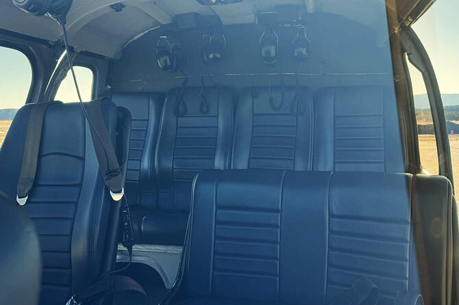
This tour is built for people who want the big Sedona hits without spending the day driving between them. From the helicopter, you get the real scale: the steep drop-offs, the odd angles of the formations, and how the canyons connect across the Mogollon Rim country.
Two details make the experience feel smoother right away. First, you sit all forward-facing, so you’re not constantly twisting your head to catch the next landmark. Second, the headsets aren’t just ear protection. With microphones, you can actually follow what the pilot is explaining and spotting as you go by.
The overall vibe is also more “in the moment” than “on a timeline.” In 50 minutes you’ll see a long string of sites, and your best job is to stay ready. When the pilot says you’re approaching something distinctive, you’ll already be looking at it.
You can also read our reviews of more tours and experiences in Sedona.
Price and Time: What $712.93 Buys in 50 Minutes
At $712.93 per person, this isn’t a budget day. The value comes from three things you can’t replicate easily on the ground.
1) Time compression: Sedona’s top landmarks and ruin country are spread out. Flying links them into one short session.
2) Angle of view: Many of the formations are dramatic partly because of their shape and placement. From the air, you see the full geometry.
3) Photo advantage: If you love rock-color contrast, shadow lines, and the “how did that happen?” look of desert erosion, the helicopter perspective does the heavy lifting.
Is it expensive? Yes. Is it fair given the route length (billed as 80+ miles), the pilot-guided experience, and the included headset/seat setup? For a one-time splurge, it often feels like a practical yes.
Before You Fly: Meeting Point, Seats, and Comfort Details
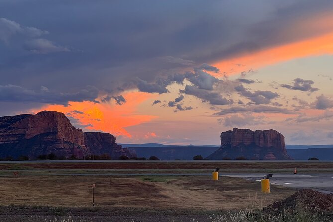
Plan on starting at 1225 Airport Rd, Sedona, AZ 86336. The activity ends back at the same meeting point, which keeps the day simpler than tours that dump you somewhere else.
A few practical comfort points matter more than people think:
- All forward-facing seats reduce the effort of “where do I look next?”
- Noise-reduction headsets with microphones help you communicate and listen without cranking volume
- Air-conditioned vehicle is included, so you’re not roasting or freezing before departure
- Most travelers can participate, but there are limits: flying is prohibited if you’re sick and the tour says you’re okay to fly if pregnant
There’s also a weight limit listed: 269 lbs per passenger (total weight). If you’re close to that, double-check before booking so you don’t risk a last-minute refusal.
Finally, you’ll be dealing with the one variable you can’t control: weather. The tour requires good weather, and if it’s canceled for poor conditions, you’ll be offered a different date or a full refund.
From the Sedona Airport Overlook to Cathedral Rock
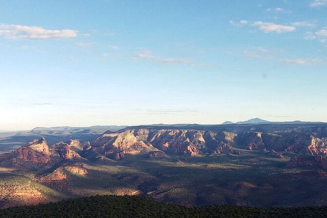
Right as you take off, the pilot gives you a fast “where we are” view. You’ll fly by the Sedona Airport overlook, which helps orient you to the surrounding red rock and canyon geometry.
Then comes Cathedral Rock. From ground level, Cathedral Rock is famous for its profile. From the air, you see it in context: how it sits relative to the surrounding ridges, and how the canyon walls frame it. The key here is to look for the way the formation separates from the background—when it does, you’re getting the real depth effect that makes aerial photos look crisp.
A small but important drawback: because the helicopter is moving, you don’t get long staring time at any one spot. Your advantage is that you still get a clean pass at the sight without having to hike to it.
Bell Rock, Submarine Rock, Snoopy, and the Praying Hands
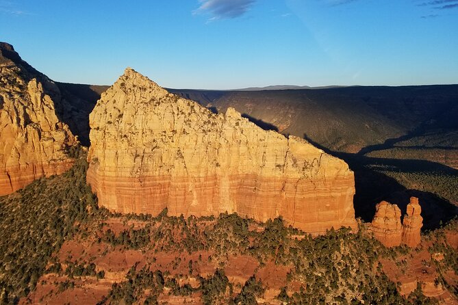
After Cathedral Rock, you’ll fly by Bell Rock, another Sedona icon where the “wow” is partly about proportions. Aerial viewing makes it easier to see the layered surfaces and how the formation rises from the surrounding rock field.
From there the route shifts into the fun zone: the helicopter fly-bys of multiple named formations close enough that you’ll feel like the desert is throwing punchlines. You’ll see Submarine Rock, Snoopy Rock, Chicken Point, and the Praying Hands from above as you pass.
This is where I love the camera setup. Don’t just hold the phone and hope. Instead, treat it like a shot list:
- For each formation, aim to capture a wide view first, then get one closer shot once you can tell which silhouette it is.
- Watch the shadow direction. Even in short passes, shadow lines help your photos look less flat.
One consideration: since these are fly-bys, you’ll want to keep your eyes up, not buried in menus. The point is to lock the look while it’s in front of you.
Cow Pies, the Eagle, Tea Kettle, and Other Signature Formations
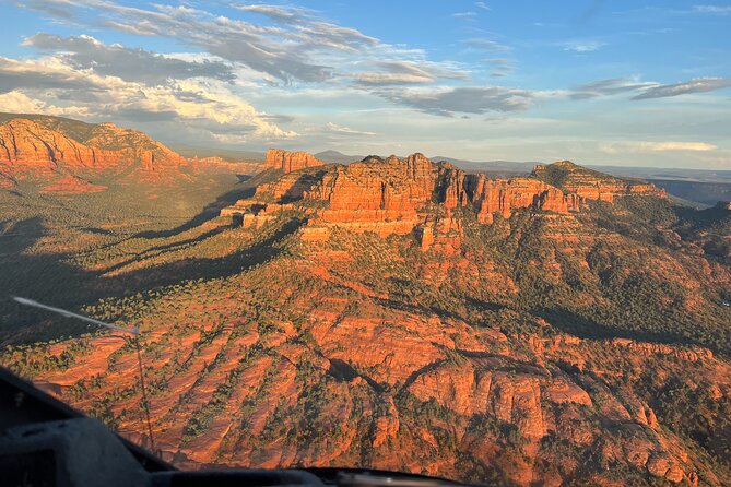
Next you’ll pass rock formations described by nicknames like cow pies, plus the eagle and the tea kettle. These names are playful, but the aerial perspective turns them into something practical: you can spot why the desert earned those labels.
From above, you also see how these shapes sit within the bigger terrain. That matters because Sedona’s rock country isn’t random. The “named” spots often mark the same type of erosion patterns, just viewed from different angles.
If you’re a serious photographer, this part of the flight is when you’ll be grateful for the included headsets. You can listen for what’s coming next and keep your hands steady. If you’re not a photographer, it’s still fun because the formations come fast enough to keep your attention locked.
Oak Creek Canyon, Midgely Bridge, and Brins Mesa Panoramas
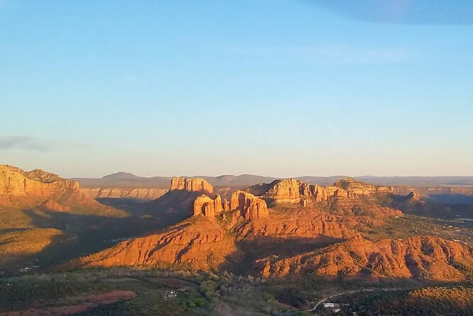
Then you’re into canyon country. You’ll see Oak Creek Canyon and Midgely bridge from above as the helicopter glides along the route.
Bridges are where aerial travel really pays off. On the ground, a bridge might be a “point.” From the air, it becomes a shape with surrounding cliffs and the route of the canyon carved underneath it.
You’ll also get epic panoramic views over Brins Mesa. This is the part that helps you understand the “80+ mile” idea in a real way. Instead of thinking in terms of individual attractions, you start seeing the region as one connected system of ridges and drainages.
A small drawback in this section: panoramas require quick decisions. If you’re waiting to frame the perfect shot, you’ll miss the best moment. I’d treat it like a moving viewpoint: grab one solid wide shot, then one detail shot, and move on.
Devil’s Bridge from the Air, Plus Honanki Ruins
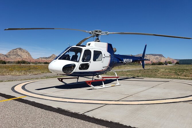
When you fly past Devil’s bridge, you get a view that’s both obvious and surprising. From the ground, it can be easy to focus on the bridge itself. From above, you see the bridge as a cut-out against steep walls, plus the broader rock shelf it sits on.
Next up: Honanki ruins. Ruin sites can be hard to interpret from one angle because details are small and spacing matters. An aerial pass helps you see the site layout—how structures relate to the surrounding terrain.
If you like cultural sites, this is also where the pilot’s guidance adds value. The ride includes information about the area’s history and geology, and the aerial perspective makes those explanations easier to picture.
Ruins Through Boynton Canyon and Long Canyon
You’ll fly through Boynton Canyon and Long Canyon, with views of ancient ruins in both areas. These canyon fly-through sections are usually the most mentally “engaging” parts of a helicopter tour because ruins make your eyes work harder.
You’ll also get a better sense of why these spots were chosen in the first place: the shape of the canyon, the protection offered by walls, and the way the terrain funnels movement.
As with all helicopter tours, you won’t have time to study artifacts up close. But you will see the spatial relationships clearly, which is a different kind of understanding than a slow museum-style visit.
The Sycamore Canyon Stop: Quick, Scenic, and Focused
One of the most practical upgrades here is that you get a specific brief stop at Sycamore Canyon, about 10 minutes, with admission ticket free. This adds a grounded moment to a ride that’s mostly about viewing from the air.
Even though the time is short, the payoff is that you can connect what you saw overhead with how it feels on-site. If you enjoy ruin viewpoints but hate feeling rushed between stops, this is a good compromise: just enough time to absorb the setting without turning your day into a hike.
Keep expectations realistic. Ten minutes is for quick orientation and photos, not a full exploration. But it’s still valuable because it turns the tour from a pure sightseeing flight into a small experience on the ground.
Cottonwood Airport Views: Tuzigoot, Jerome, Verde River, and Wilderness Country
On your way out and back, the tour notes that you’ll have views of Tuzigoot National Monument as you depart from and arrive to the Cottonwood Airport. This is a smart way to add variety without adding extra stop times.
From there, you’ll pass Mingus Mountain and Woodchute wilderness area and also see Jerome as you fly toward Sycamore Canyon. Jerome’s place on the map is one of those quick visual cues you’ll pick up fast from the air: you get a sense of where the town sits against the surrounding highlands.
You’ll also see the Verde River from above, which gives the route a “life line” view. Rivers make the arid terrain easier to understand. They explain why green corridors exist and why canyons cut the way they do.
Who Should Book This Helicopter Tour (and Who Might Want Another Option)
This tour fits best if you:
- Want a high-impact, low-effort way to see major Sedona icons
- Like aerial photography and want the real scale of formations and canyon walls
- Enjoy learning from a pilot and hearing context through the headset
- Are traveling as a small group since the experience is limited (maximum listed 6 travelers, and groups up to 5)
It may be less ideal if you:
- Need long viewing times at each site
- Want a deep, walking-focused experience at ruins
- Get very anxious in fast-moving, loud environments (the headsets help, but it’s still a helicopter)
If you’re pregnant, the tour says it’s okay to fly, which is reassuring. But if you’re sick, you won’t be allowed to fly, so align your timing with your health.
Should You Book Apex Air Tours for This 80+ Mile Flight?
If you’re deciding between “more time driving” and “one unforgettable aerial loop,” I’d lean toward booking—especially if you want Cathedral Rock, Bell Rock, Devil’s Bridge, multiple ruin areas, and named rock formations all in one shot.
The main reason to book is simple: the combination of forward-facing seating, headsets with microphones, and a route that strings together famous and historic sites makes this feel efficient without feeling generic. You’re not just paying for a helicopter. You’re paying for a guided, structured run through Sedona’s most photogenic terrain and ruin country.
If you do book, come with a plan for your camera. Treat each named feature like a shot you have seconds to grab. And be ready for the fact that the helicopter turns “I’ll see it later” into “it’s right there now.”
FAQ
How long is the Sedona Helicopter Tour?
The flight is approximately 50 to 52 minutes.
How much does the tour cost?
The price is $712.93 per person.
Where does the tour start and end?
It starts at 1225 Airport Rd, Sedona, AZ 86336, USA, and ends back at the meeting point.
What seats are provided?
The tour includes all forward facing seats.
Are noise-reduction headsets provided?
Yes. You get noise reduction headsets with microphones.
What group size can I expect?
The experience lists a maximum of 6 travelers, and it notes groups of up to 5 in total.
What is the weight limit per passenger?
The listed total weight per passenger is 269 lbs.
Is the tour offered in English?
Yes, the tour is offered in English.
Can I fly if I’m pregnant?
The tour says it is okay to fly if pregnant.
What happens if weather is poor?
The tour requires good weather. If canceled due to poor weather, you’ll be offered a different date or a full refund.
Can I cancel for a full refund?
You can cancel for a full refund if you cancel at least 24 hours in advance. If you cancel less than 24 hours before the experience starts, the amount paid isn’t refunded.