REVIEW · SEDONA
Ancient Sedona (30+ Mile) – Sedona Helicopter Tour
Book on Viator →Operated by Apex Air Tours · Bookable on Viator
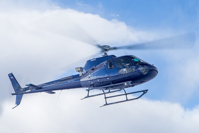
Sedona looks incredible from the ground. Seeing it from above turns those same icons into a map you can almost read. This 30+ mile helicopter tour strings together famous red-rock formations and remote canyons in a short flight, with all-forward seating that keeps views in front of you.
What I like most is how the route is built around big-name landmarks plus lesser-seen corners, so you get variety without wasting time. The other win is the onboard experience: you get a noise-reducing headset with microphone, and you’re not stuck staring down at your lap since the seating is all facing forward.
One thing to consider: at about 20–22 minutes, it’s not a long scenic loop. If you want lots of airtime and slower sightseeing, you may feel the clock a bit quickly.
In This Review
- Key things to know before you fly
- Getting to the helicopter: Sedona Airport Rd and a quick start
- Price and value: what $306.48 buys you in real terms
- How 20–22 minutes feels: fast, focused, and built for photos
- Red Rock State Park to Cathedral Rock: the view-angle upgrade
- Chapel of the Holy Cross, Bell Rock, and the icons that line up
- Broken Arrow Trail, Praying Hands, and the rock formations that look different in 3D
- Courthouse Butte, Snoopy Rock, Tea Kettle, and the fun side of Sedona
- Oak Creek Canyon and Midgely Bridge: depth, water, and scale
- Steamboat Rock, Ship Rock, the Fin, and the canyon walls that feel close
- Secret Canyon, Secret Mountain, and ancient ruins you can’t spot easily
- Coffee Pot Rock, Soldiers Pass, the Mitten, Sphinx Rock, and the shape-shift moment
- Seven Canyons golf course, Schuerman Mountain, and the return sweep
- Seat comfort, headset use, and how to make the most of every minute
- Who this Sedona helicopter tour is best for (and who should reconsider)
- Should you book Ancient Sedona (30+ Mile)?
- FAQ
- How long is the Sedona Helicopter Tour?
- Where do I meet for the Ancient Sedona (30+ Mile) tour?
- What is included with my ticket?
- What is the price per person?
- Is there a weight limit?
- How many people are in the helicopter?
Key things to know before you fly
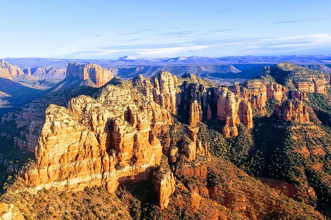
- 30+ miles of Sedona views packed into roughly 20–22 minutes
- All-forward seating so you’re always looking at the action
- Headsets included to make pilot talk and canyon views easier to follow
- A small group size (maximum of 6) for a quieter, more personal feel
- A route built for icons and ruins like Cathedral Rock, Chapel of the Holy Cross, and ancient Sinagua ruins
- Weather-dependent flying with a plan for rescheduling or a full refund if poor conditions cancel the trip
Getting to the helicopter: Sedona Airport Rd and a quick start
Most helicopter rides feel intimidating until you’re actually there, and this one keeps things simple. You meet at 1225 Airport Rd, Sedona, AZ 86336, and the tour begins with a takeoff/landing moment where you can get your bearings fast.
The flight setup matters more than you’d think. With all forward-facing seating, you’re not guessing where to look next. That’s especially helpful on a route that covers a lot of named landmarks in a short time.
Because this is a small-capacity experience (maximum 6 travelers), the vibe tends to be calm and efficient. You’ll usually spend your energy on looking out the window, not on waiting around.
You can also read our reviews of more tours and experiences in Sedona.
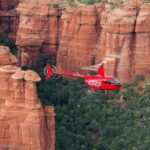
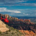
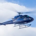
Price and value: what $306.48 buys you in real terms

At $306.48 per person, this isn’t a budget activity. But it isn’t “pay for nothing” money either.
Here’s where the value comes from:
- You’re paying for a helicopter vantage point, not just sightseeing from a road.
- The route covers 30+ miles in a tight window, which can be hard to recreate any other way in Sedona.
- You get practical comfort perks built in, including air-conditioned vehicle and noise-reducing headsets.
- The max group size (up to 6) helps keep the experience from feeling crowded.
If you’re trying to choose between a long road tour and this flight, think of it as buying time and perspective. Helicopters compress distance, and they let you see formations from angles that trails simply can’t provide.
How 20–22 minutes feels: fast, focused, and built for photos
This tour runs about 20–22 minutes. That’s a sweet spot if you want a big visual hit without turning your whole day into logistics.
You’ll notice a pattern: the pilot moves quickly from one “signature” viewpoint to the next, then slows just enough for you to recognize what you’re looking at. That matters because Sedona has lots of rock shapes, but from above, the names start making visual sense.
Practical tip: don’t chase every single feature like it’s a scavenger hunt. Pick a few favorites, look for the shapes that match the names you care about, and let the rest become “wow” moments. The route is packed, and your eyes will thank you for focusing.
Also keep in mind the basic health and safety boundaries. The activity notes that you should not fly if you are sick, and there’s a total weight limit of 269 lbs per passenger.
Red Rock State Park to Cathedral Rock: the view-angle upgrade
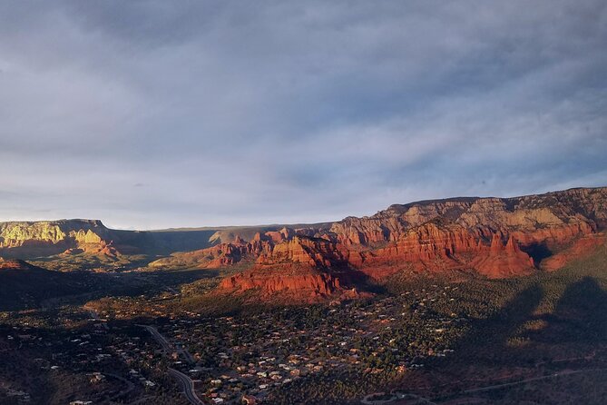
After the takeoff/landing overlook, you’ll fly by Red Rock State Park. From the air, the park isn’t just “red rock.” You start seeing how the ridges and valleys connect, and how trails and formations line up in layers.
Then comes Cathedral Rock, with a fly-by that puts you closer to the top of the formation than most ground viewpoints allow. Cathedral Rock is famous on photos, but from the air, it becomes a 3D object with edges, shadows, and depth. You’re not just looking at a landmark—you’re seeing why it looks the way it does.
This is one of those stretches where the angle changes the story. On the ground, you’re always at one vantage point. In the air, you get multiple angles in minutes.
Chapel of the Holy Cross, Bell Rock, and the icons that line up
Next, you’ll pass the Chapel of the Holy Cross. From above, you can appreciate how the chapel sits against the rock backdrop, not as an isolated building but as part of the cliff-and-canyon setting.
After that, you’ll see Bell Rock from the air. Bell Rock has a recognizable silhouette, but aerial views show the surrounding contours that help you judge scale. The air makes it easier to understand how the rocks shape the routes of canyons and washes below.
These are the classic Sedona stops, and they’re classic for a reason. Still, the helicopter version is different. Instead of admiring from a single pull-off or viewpoint, you watch the icons slide past like landmarks on a living map.
Broken Arrow Trail, Praying Hands, and the rock formations that look different in 3D
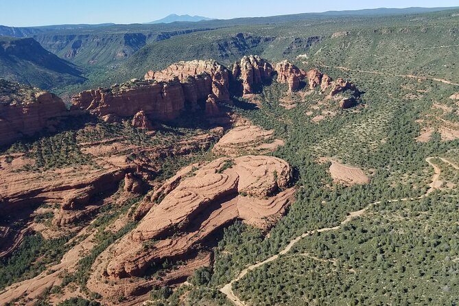
One of the best parts of this route is how it reaches into areas you’d never fully grasp from the road. You’ll fly by the Broken Arrow Trail, including views of the Praying Hands, Chicken Point, and Submarine Rock.
From ground level, the Praying Hands are a single recognizable shape. From above, they become a section of a larger rock system—like you’re seeing the “diagram” behind the photo. That’s the kind of perspective change that makes a helicopter worth considering.
The same idea applies to formations like Submarine Rock. The name cues what it resembles, but aerial sightlines help you see why it sits the way it does relative to the canyon walls and ridges.
Courthouse Butte, Snoopy Rock, Tea Kettle, and the fun side of Sedona
Sedona can be serious-pretty, but it also has playful rock names—and the flight leans into that fun. You’ll fly by Courthouse Butte, then see Snoopy Rock, the Tea Kettle, Eagle Rock, and the Cowpies.
This is where you’ll appreciate the all-forward layout. When formations appear on your right or left, you can track them as they move through your field of view. You won’t end up with a seat that forces you to twist.
A note for photos: aerial shots can look “cleaner” than ground shots because you avoid foreground distractions. That doesn’t mean every photo will be perfect, but it does mean the view is easier to frame.
Oak Creek Canyon and Midgely Bridge: depth, water, and scale
Next up is Oak Creek Canyon, including a look at Midgely Bridge from the air. Oak Creek Canyon is known for its depth on the ground, but from above you can see how the canyon cuts through the rock layers.
If you’re hoping for water moments, this route has timing built in. You’ll also fly past a canyon full of rock pillars and seasonal waterfalls. Since that’s seasonal, conditions will vary, but the aerial angle is still a strong payoff when water is present.
A helicopter doesn’t just show “a canyon.” It shows how the canyon system connects to neighboring ridges and side cutbacks. That’s the kind of mental map you usually have to build over multiple hikes.
Steamboat Rock, Ship Rock, the Fin, and the canyon walls that feel close
This section of the flight focuses on rock stacks and canyon details: Steamboat Rock, Ship Rock, and the Fin, plus additional views deeper into canyon country.
Here’s why it matters: the “wow” feeling on hikes often comes from standing near a feature and realizing its size. From the helicopter, you experience the same scale surprise, but faster. The walls sweep under you, and the rock shapes pop because they’re framed by shadow and distance.
Even if you’ve seen these names on the ground, aerial views can reset your understanding of spacing—how far one formation is from the next, and how the canyon walls bend where you can’t usually see.
Secret Canyon, Secret Mountain, and ancient ruins you can’t spot easily
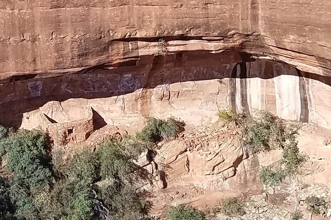
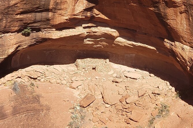
Now the route shifts from postcard icons to older, more remote-feeling spots. You’ll fly through Secret Canyon past Secret Mountain, then fly through Boynton Canyon and Long Canyon, where you’ll see ancient ruins.
Sedona has many layers, and this is where the air helps you connect pieces. When ruins are involved, the challenge from the ground is often that you see them from one angle, maybe through vegetation or from a distance. From above, the geometry of the canyon and the placement of features becomes easier to read.
The “ancient ruins” note is also a reminder to keep expectations grounded: you’re viewing from the air, not walking to interpret each site up close. Think of this as aerial context—seeing where these places sit in the larger environment.
Coffee Pot Rock, Soldiers Pass, the Mitten, Sphinx Rock, and the shape-shift moment
The flight continues with a fun cluster of named formations: Coffee Pot Rock, Soldiers Pass, the Mitten, and Sphinx Rock.
Then you’ll get one of the most satisfying “wait, what?” moments: watching Chimney Rock turn into the 3 fingers as perspectives change.
That shift is a big deal. These kinds of rocks often look like one thing from a single viewpoint. In the air, you watch the angles change and the shape resolves into multiple “reads.” It’s one of those instant-learning moments where Sedona’s famous look makes more sense.
Seven Canyons golf course, Schuerman Mountain, and the return sweep
As you head back toward the airport, you’ll fly by Seven Canyons golf course, then enjoy spectacular views as you pass over Schuerman Mountain on the way back to the meeting point.
This isn’t filler. The return leg is another chance to see how Sedona’s rock country fits together outside the main hotspots. By the time you’re heading home, you’ll likely feel like you have a stronger grasp of where canyons cut through the region.
And you finish back at the start point, so you’re not dealing with a complicated end location.
Seat comfort, headset use, and how to make the most of every minute
Two details really improve the experience in practice:
- All forward-facing seating
- Noise-reducing headset with microphone
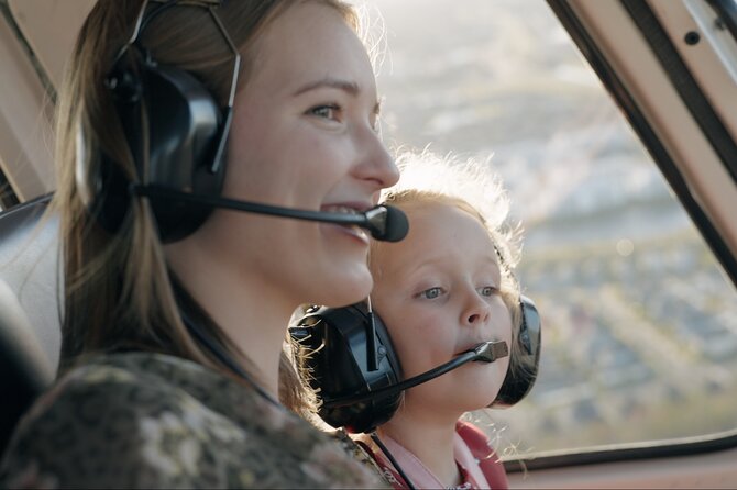
With a helicopter, sound is part of the experience, but it can also be frustrating without proper hearing protection. The included headsets help you catch the pilot’s callouts instead of guessing what you just flew past.
Also, since the group is limited to no more than 6, you’re more likely to get a smoother process from start to finish. That matters because the flight is short; you don’t want time wasted.
For photography, expect reflections. You might need to wipe a window spot or angle your phone/camera carefully to reduce glare. The good news is that Sedona’s bright red rock tends to show up strongly even when lighting isn’t perfect.
Who this Sedona helicopter tour is best for (and who should reconsider)
This tour is a great fit if you:
- Want big aerial views without committing to hours
- Prefer forward-facing seating so you don’t hunt for angles
- Enjoy classic Sedona icons plus the feeling of remote canyon country
It may be less ideal if you:
- Crave a slower pace or longer time in the air
- Want a deep on-the-ground exploration experience (this is a fly-over and view experience)
Also, take the physical limits seriously. If you’re not feeling well, this notes that you shouldn’t fly. And if you’re near the 269 lbs limit, plan accordingly.
Should you book Ancient Sedona (30+ Mile)?
If you want a high-impact Sedona experience that compresses distance into a tight, satisfying flight, I think this one makes sense. The combination of 30+ miles, all-forward seating, and a route built around both well-known and lesser-seen formations is a strong value formula for the price.
Book it sooner if you can, since the typical booking window averages about 16 days in advance. And if weather is shaky, don’t panic—this activity requires good conditions, with a plan to offer another date or a full refund if it gets canceled due to poor weather.
FAQ
How long is the Sedona Helicopter Tour?
The flight is approximately 20 to 22 minutes.
Where do I meet for the Ancient Sedona (30+ Mile) tour?
You meet at 1225 Airport Rd, Sedona, AZ 86336, USA, and the activity ends back at the meeting point.
What is included with my ticket?
Your ticket includes a noise-reducing headset with microphone, all forward-facing seating, and an air-conditioned vehicle.
What is the price per person?
The price is $306.48 per person.
Is there a weight limit?
Yes. The tour lists a total weight per passenger of 269 lbs.
How many people are in the helicopter?
The experience has a maximum of 6 travelers. The tour notes a maximum traveler count of 6.