REVIEW · SEDONA
Secret Wilderness (45+ Mile) – Sedona Helicopter Tour
Book on Viator →Operated by Apex Air Tours · Bookable on Viator
Red rocks look different from the sky.
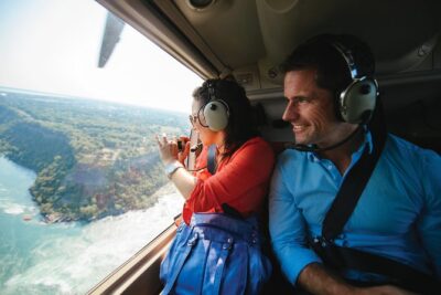
This Secret Wilderness (45+ Mile) Sedona helicopter ride is a fast, focused way to see the big-name formations and the quieter canyons from above, with forward-facing seats and a noise-reducing headset so the ride stays comfortable.
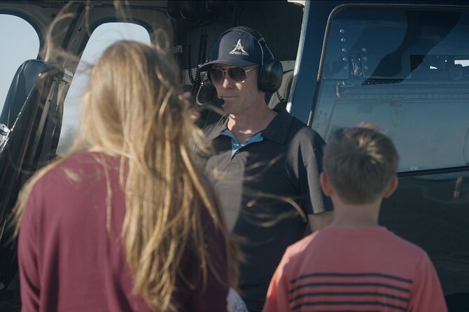
I really like the small-group feel and the way the route stacks sight after sight—Cathedral Rock, the Chapel of the Holy Cross, the Praying Hands, Bell Rock, Devil’s Bridge, plus deep stops like Secret Canyon and Boyton Canyon. It also helps that pilots (including Steve, Conor, and Joshua) are described as friendly and hands-on, calling out what you’re seeing as you fly.
One consideration: it’s not a long flight (about 30–32 minutes), and it depends on good weather. If conditions are rough, you may need to reschedule—usually without drama, but it’s still something to plan for.
In This Review
- Key things I’d bookmark before you go
- Getting airborne fast at 1225 Airport Rd
- Why the “Secret Wilderness” angle feels worth it
- The first wave of Sedona icons you’ll spot from above
- The canyon system: from Oak Creek mouth to seasonal waterfalls
- Deeper into the “only-on-foot” areas: Secret Canyon and Sinagua cliff dwellings
- The quieter payoff near the end: Lower Chimney Rock and big return views
- Price and value: what you’re really buying for $438.30
- Who this tour suits best (and who might rethink it)
- Quick tips to make your flight feel smoother
- Should you book Secret Wilderness (45+ Mile) in Sedona?
- FAQ
- How long is the Secret Wilderness (45+ Mile) helicopter tour?
- Where does the tour start and end?
- What’s included with the flight?
- How many people are on the tour?
- Is the tour offered in English?
- Is there a weight limit?
- Do you need good weather for the flight?
- What’s the cancellation policy?
- How far in advance should I book?
Key things I’d bookmark before you go
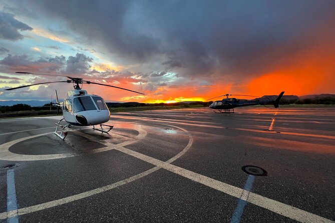
- 45-mile route over Sedona red rock country with a tight schedule and lots of landmarks
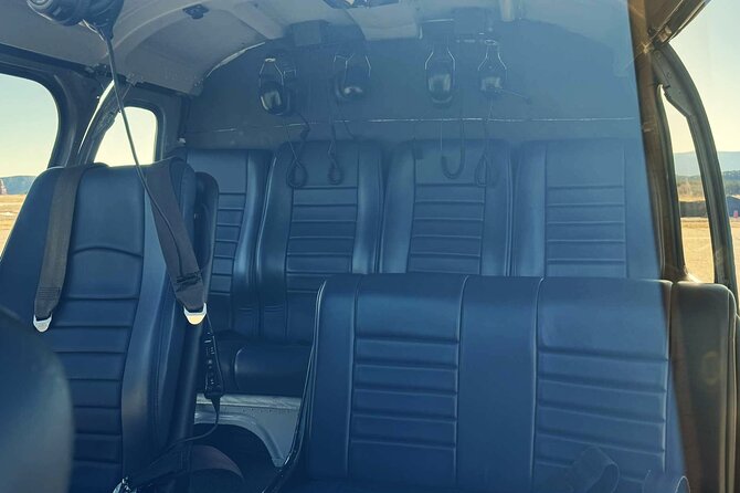
- All forward-facing seats plus a noise-reducing headset so you can actually enjoy the ride
- Small group size (max 6 travelers) for a more personal flight experience
- Eye-level Cathedral Rock and the Praying Hands for views you just can’t get on foot
- Secret Canyon + Boyton and Long Canyons for a wilder, more remote feel from the air
- Close aerial passes over famous hikes like Bell Rock, Devil’s Bridge, and Midgely Bridge
Getting airborne fast at 1225 Airport Rd
You start at 1225 Airport Rd in Sedona, and the whole experience is built around quick takeoffs and landings. Right after you lift off, you’ll get an initial aerial “welcome” view over the area, including major formations like Thunder Mountain, Coffee Pot Rock, Ship Rock, and other recognizable Sedona shapes.
This matters more than you’d think. A helicopter tour works best when you get your bearings early, and those first passes help you spot where everything sits—so later, when you’re flying above canyons and cliff formations, you’re not just looking at pretty rocks. You’re learning how the system fits together.
One practical detail: the tour includes an air-conditioned vehicle, which is a nice buffer in Sedona heat, and you’ll use a mobile ticket. If you’re the type who likes to arrive calm and not rushing, aim to get there with extra time so check-in feels easy.
You can also read our reviews of more tours and experiences in Sedona.
Why the “Secret Wilderness” angle feels worth it
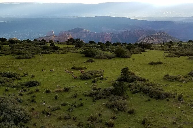
Most helicopter rides are either short and generic, or they focus on only a handful of areas. This one is different: the name isn’t just marketing. The route spends real time looking into deeper wilderness-style corridors—places that are only reachable on foot if you hike for a while.
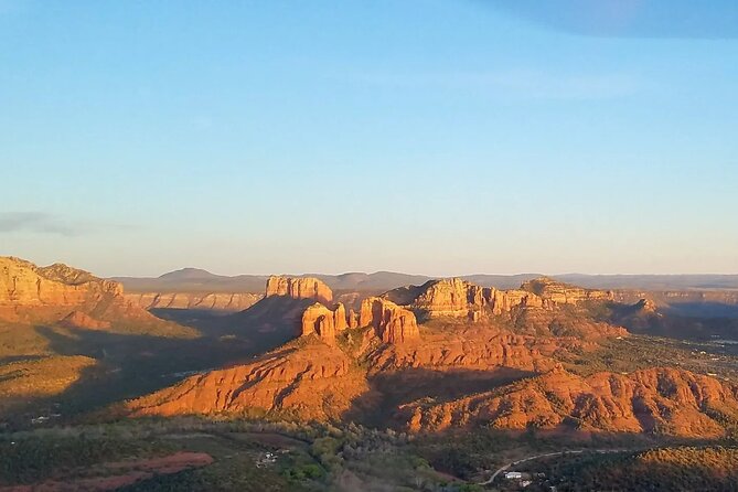
That’s where it starts to feel like “Secret Wilderness” instead of “usual highlights.” You’ll still see the famous icons from the ground—Cathedral Rock, Bell Rock, the Chapel of the Holy Cross, and the Praying Hands—but then the flight presses further into canyon country like Secret Canyon and Bear Sign Canyon, and you’ll fly above rock-and-cliff areas tied to the Sinagua cliff dwellings.
Even if you’ve never hiked those trails, you’ll feel the difference. From the air, you can see how narrow and protected some of these canyons are, and how the rock towers create natural walls. It’s not just a view; it’s context.
The first wave of Sedona icons you’ll spot from above
This tour uses the opening stretch to cover the headline formations in an efficient loop. You’ll fly by Red Rock State Park, then get views over Oak Creek and surrounding features like Schuerman Mountain and Pyramid Rock.
Next comes Cathedral Rock, and this part is built for maximum wow-per-minute. You’ll see it from an eye-level perspective, including a look at the top that most people never get. As the route rounds Cathedral Rock, you’ll be able to pick out the Chapel of the Holy Cross and the Praying Hands—again, from a high vantage point where their placement relative to the surrounding rock layers is suddenly obvious.
Then the itinerary turns into a highlight reel of famous hikes and formations—things you can point out later when you’re back on the ground. Here’s what you can expect in this phase:
- Bell Rock: one of the most popular hiking spots in the Sedona area. From the air, you see the geometry of the formation in a way trail photos can’t capture.
- Broken Arrow Trail: you’ll fly over views tied to the Praying Hands plus Chicken Point and Submarine Rock.
- Courthouse Butte: a tall centerpiece (over 1,000 feet) that’s known to attract climbers and base jumpers. From above, its mass becomes easy to understand.
- Snoopy Rock, Tea Kettle, Eagle Rock, and Cowpies: several recognizable Sedona “shapes” appear as you pass through the red-rock mix.
You’ll also get a pass over Grasshopper Point, described as a popular swimming spot—so you can visually connect the water/park area to the surrounding rock walls.
And then you’ll see Midgely Bridge from the air. Since it’s a distinctive arch landmark, the overhead view helps you see how it sits across the terrain instead of only what you can frame from one trailhead.
The canyon system: from Oak Creek mouth to seasonal waterfalls
The flight continues with more dramatic geometry, especially around Oak Creek Canyon. You’ll get a view at the mouth of Oak Creek Canyon, which matters because it’s where the famous Oak Creek flows—an important clue for understanding the region’s year-round water story.
Next up are views of Ship Rock and the Fin, plus a canyon section described as full of rock pillars and seasonal waterfalls. The “seasonal” part is key. Even if it’s not peak flow, you’ll likely see patterns in the rock channels—where water cuts through and how the canyon walls funnel it.
If you like interpreting terrain, this is the stage where the tour stops being just sightseeing and turns into a quick geography lesson. You’ll start spotting drainage lines, cliff edges, and where the canyon walls create natural corridors—stuff that’s hard to see from the ground unless you’re hiking for hours.
Deeper into the “only-on-foot” areas: Secret Canyon and Sinagua cliff dwellings
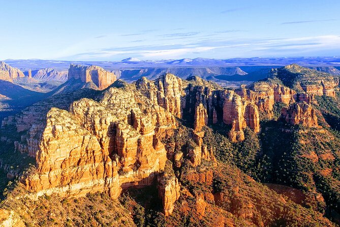
This is one of the most praised ideas in the route: going where few people see Sedona from above because it takes time to reach by foot. You’ll fly through Secret Canyon and by Secret Mountain, described as part of a wilderness area that’s only reachable by extensive hiking.
Then you’ll pass Bear Sign Canyon along the way, which the tour describes as offering one of the best panoramas in the area. From a passenger perspective, this tends to be the segment where everyone stops talking just long enough to take it all in. The canyon walls look higher. The turns look tighter. The remoteness feels real.
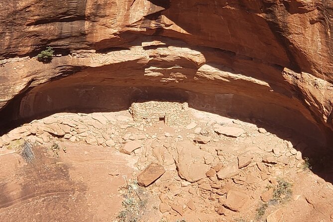
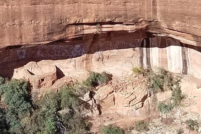
After that, the flight moves into Boyton Canyon, one of the most beautiful canyons in the Sedona area. You’ll also fly by Sinagua cliff dwellings, which adds a human layer to the scenery. You’re not just looking at rock formations—you’re seeing how ancient people used cliffside shelter and how those sites are positioned relative to the canyons.
Right next to Boyton Canyon is Long Canyon, with more canyons and additional cliff dwelling areas mentioned on the route. Even from a seat, you can see how the terrain likely influenced where people built and how they traveled.
Finally, you’ll pass other hiking-linked features like Mescal Mesa, including a mention of the Birthing Cave hike, and Doe Mountain for a great afternoon-style panorama of Sedona’s red rocks from that vantage point.
The quieter payoff near the end: Lower Chimney Rock and big return views
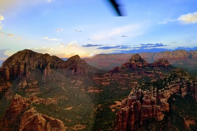
As you work toward the back half, you’ll see Lower Chimney Rock Trail with a neat aerial perspective change: the tour describes Chimney Rock turning into the “3 fingers” as you change perspectives. From the ground, that kind of shape-shift takes time and effort to understand. From the air, it’s quick.
Then, on the way back, the flight tops off with broader views as you return to the airport. You’ll get sweeping looks of surrounding red rock around Sedona, including views you may not catch from common viewpoints—like Cathedral, Bell Rock, Schnebly Hill, Ship Rock, Coffee Pot Rock, and Thunder Mountain.
This return segment is also where the helicopter’s advantage really shows. You’re not just repeating the same route. You’re seeing how the formations relate to each other when the whole area opens up.
Price and value: what you’re really buying for $438.30
At $438.30 per person for about 30–32 minutes, this isn’t a budget activity. The value comes from three things that add up fast:
- You’re compressing many iconic viewpoints into one ride. In one trip you cover Cathedral Rock, the Chapel of the Holy Cross, the Praying Hands, Bell Rock, Devil’s Bridge, Midgely Bridge, and multiple canyon systems.
- You’re getting forward-facing viewing. That reduces the “sit-and-hope” effect you sometimes get on tours where half the aircraft is looking at the same direction. Here, your odds of a great view are higher for everyone on board.
- The headset and ride setup make the experience easier to enjoy. The noise-reducing headset with a microphone helps you stay comfortable and listen as the pilot talks through what’s happening outside.
I’d also add one subtle value point: the tour is designed as a high-sight-per-minute experience, not a slow narration stroll. If you’re short on time in Sedona, this kind of flight can feel like the best use of a limited afternoon—even though you’re only in the air for about half an hour.
Who this tour suits best (and who might rethink it)
This tour is a strong fit if you:
- Want a once-in-a-while splurge that gives you a ton of visual payoff in a short window
- Like iconic destinations and want some deeper canyon areas you won’t easily reach by hiking
- Prefer real-time pilot guidance over pre-set audio narration
It may not be the best match if you:
- Have a tight schedule and can’t handle weather-based changes. The experience needs good weather to fly.
- Want a long seated ride. This one is short by design.
One encouraging note from rider feedback: even people who generally dislike heights have said the flight didn’t feel scary. That doesn’t mean it’s risk-free—just that the ride experience can feel smooth and controlled.
There’s also a 400 lbs total weight per passenger limit, and you shouldn’t fly if you’re sick. Most people can participate, but if either of those points applies to you, it’s worth planning carefully.
Quick tips to make your flight feel smoother
- Wear comfortable clothes and plan for quick boarding times. You’ll be in and out fast.
- Bring eye comfort (sunglasses can help with glare) since you’ll be scanning rock formations the whole time.
- If you’re prone to motion discomfort, consider how you normally feel on vehicles. The tour notes a smooth ride in feedback, but everyone’s body is different.
- If you want the best photo angles, sit where the pilot’s described route is pointing—most of your seats are forward-facing, so this is usually easier than it sounds.
Should you book Secret Wilderness (45+ Mile) in Sedona?
Yes, if you want a high-impact Sedona experience that mixes famous red-rock icons with real “wilderness-feeling” canyon flyovers. The small group, forward-facing seats, and noise-reducing headsets make the time in the air feel respectful of your attention.
I’d book it sooner rather than later if you can. It’s commonly reserved about a week in advance, and weather is the one wildcard in the mix.
If you’re on the fence because of the price, I’d compare what you’d get for the same time on the ground. A lot of hikes can be amazing, but this tour gives you a moving aerial map in one sitting—plus it puts you above places like Secret Canyon and Boyton Canyon that most people only imagine.
If Sedona is your one big stop and you want the sky-view moment, this is a solid way to lock it in.
FAQ
How long is the Secret Wilderness (45+ Mile) helicopter tour?
The flight typically runs about 30 to 32 minutes.
Where does the tour start and end?
It starts at 1225 Airport Rd, Sedona, AZ 86336, and ends back at the meeting point.
What’s included with the flight?
You get a noise-reducing headset with microphone, all forward-facing seating, and an air-conditioned vehicle.
How many people are on the tour?
The experience has a maximum of 6 travelers, with very small group seating.
Is the tour offered in English?
Yes, it’s offered in English.
Is there a weight limit?
Yes. The total weight per passenger is 400 lbs.
Do you need good weather for the flight?
Yes. The experience requires good weather, and if it’s canceled due to poor weather you’ll be offered a different date or a full refund.
What’s the cancellation policy?
You can cancel for free up to 24 hours in advance for a full refund. If you cancel less than 24 hours before the experience starts, the amount paid is not refunded.
How far in advance should I book?
On average, it’s booked about 7 days in advance.