REVIEW · OAHU
30 Minutes PRIVATE Helicopter Tour in Honolulu
Book on Viator →Operated by Honolulu Helicopter Tours · Bookable on Viator
30 minutes overhead can change your whole trip. This private helicopter tour is built for a big-picture view fast: you lift off near HNL, spend about 30 minutes in the air, and get a bird’s-eye scan of Oahu’s coastline, harbors, and mountain backdrops while your pilot points out what you’re seeing. I especially like the privacy of doing it with just your group, and I like that the short flight still covers a lot of landmarks in one sweep.
The main thing to weigh is that it’s weather dependent and the flight time is short, so you’re not going for a long scenic loop. Also note the 300 lb per passenger weight limit, which can affect who in your group is able to go.
In This Review
- Key things I’d watch for before you book
- Why a 30-minute private helicopter flight makes sense in Honolulu
- The price tag: what $359 per person buys you
- Where the flight starts: finding 1 Lagoon Dr without stress
- Your aerial route: what each part of the flight is good for
- HNL to Sand Island: the harbor-meets-shore feeling
- Honolulu Harbor and Ala Moana Beach Park: boats, curves, and the city edge
- Magic Island and Ala Wai Harbor: the Waikiki boundary line
- Waikiki and Diamond Head: the postcard view, but with context
- Waialae Golf Course and Honolulu Downtown: check the city scale
- Punch Bowl Cemetery: a view you can’t get on foot
- H201 Interchange and H3 Highway: the island’s movement patterns
- Aloha Stadium and Moanalua Gardens: big sites, softer edges
- Black Point Sea pools and Moanalua backwater areas
- Waialae Golf Course repeats your earlier “land use” lesson
- Comfort details that actually matter: headset, phone lanyard, and pilot narration
- Who should book this private helicopter tour
- Weather, weight, and timing: how to plan so the day stays smooth
- Photo and video tips for a 30-minute flight (without stressing)
- Should you book 30 Minutes PRIVATE Helicopter Tour in Honolulu?
- FAQ
- How long is the helicopter tour?
- Is the 30 minutes the time in the air?
- How much does it cost?
- Is this tour private?
- Where does the tour start and end?
- What’s included in the tour?
- Is there a weight limit?
- Do I need good weather for this experience?
- When do I receive confirmation after booking?
- Can I cancel for a refund?
Key things I’d watch for before you book
- Private group time: Only your group flies, so you’re not squeezed in with strangers.
- 30 minutes in the air: Short enough to fit a day schedule, long enough to actually spot lots of places.
- Pilot-led landmark spotting: You’ll get guidance on famous sights as you fly over.
- Included headset + phone lanyard: Aviation headsets and a provided cell phone lanyard make the experience easier.
- Weight limit applies: Total weight per passenger is capped at 300 lbs.
Why a 30-minute private helicopter flight makes sense in Honolulu
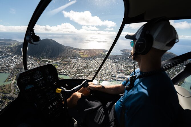
Helicopter rides can feel expensive until you get the perspective. From the ground, Honolulu is great, but it’s also spread out. This tour gives you an “entire city in one look” view without requiring a full day plan.
I like that the experience is designed around one simple idea: get you into the air for about half an hour and let the coastline and landmarks do the talking. You’re not waiting around for hours just to get a quick look out a window. You’re up, you’re moving, and you’re seeing multiple areas during that 30-minute flight time.
Also, the private format matters more than you might expect. When it’s just your group, you can relax through the earsets, the noise, and the brief pre-flight moments. It feels more like a guided outing than a cattle-call attraction.
The other practical upside: it’s easy to plan around 30 minutes. If your trip is busy with beaches, hikes, and food stops, this gives you a high-impact view without turning your schedule upside down.
You can also read our reviews of more tours and experiences in Oahu.
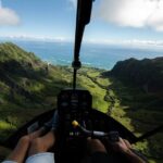
The price tag: what $359 per person buys you
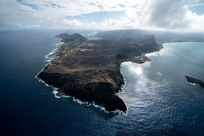
At $359 per person for a 30-minute private helicopter tour, this is not a casual add-on. So I look at it like a “value per wow moment.”
Here’s what makes the price easier to swallow:
- You’re paying for private time in a helicopter, not a shared bus-style tour.
- You’re getting included aviation headsets, which improves comfort and helps you actually hear your pilot.
- You’re also getting a provided phone lanyard, which is a small thing until you’re holding your phone while moving through loud rotor air.
If you’re traveling solo, it can feel like a lot. If you’re splitting the cost with a couple of friends or family members, it shifts closer to “worth it” territory because you’re truly buying a private flight experience rather than just paying for a seat.
One more thing to keep in mind: average booking timing is about 13 days in advance. That suggests demand can run steady, so I’d treat it as something you should lock in once your Oahu day plan is solid.
Where the flight starts: finding 1 Lagoon Dr without stress
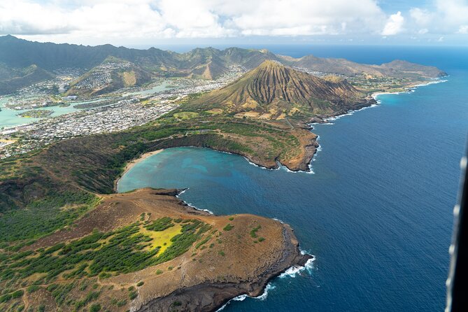
The tour meets at 1 Lagoon Dr, Honolulu, HI 96819, and it returns to that same meeting point. That round-trip structure helps. You’re not ending up across the island with transportation questions hanging over your head.
The location is also listed as being near public transportation. That matters if you’re not planning on using a rental car for this day segment. Even if you are driving, “near public transportation” usually signals it’s in a workable part of the city, not on some remote access road.
The good news: there’s an easy-to-find departure point, and the tour uses a mobile ticket. So you can keep things simple—show the ticket on your phone and focus on getting to the pickup spot on time.
Your aerial route: what each part of the flight is good for
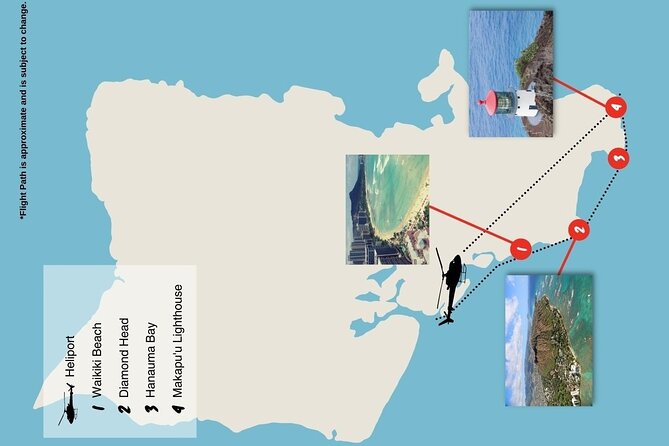
You’ll start and stop at HNL, then fly over a set loop of Honolulu-area landmarks. The best way to think about the route is like this: each segment gives you a different “type” of view—harbor, shoreline, Waikiki frontage, downtown angles, and the island’s interior ridgelines.
Here’s what you can expect as you move through the flight.
HNL to Sand Island: the harbor-meets-shore feeling
You begin your flight around HNL, then head toward Sand Island. This is a great starting stretch because you’re transitioning from the airport area into the wider coastal picture. From above, the mix of built shoreline and ocean texture is usually easier to understand than it is from the beach.
Why you’ll care: it helps you orient yourself quickly. Once you see how the airport area lines up with the surrounding water, the rest of Honolulu starts clicking into place.




Honolulu Harbor and Ala Moana Beach Park: boats, curves, and the city edge
Next up: Honolulu Harbor and Ala Moana Beach Park. These zones are all about geometry. From the air, you’ll get clean views of harbor layout, coastline shape, and how the beach areas sit next to the built-up city.
Why you’ll care: this is where you see Honolulu’s “coastal city” character in one snapshot. It’s not just one beach—it’s the whole system.
Magic Island and Ala Wai Harbor: the Waikiki boundary line
After that you’ll fly past Magic Island and Ala Wai Harbor. This is the part that usually makes people smile because it frames Waikiki from above. The harbor and the shoreline combine into a clear visual boundary between ocean activity and city infrastructure.
Possible drawback: if your only priority is a long view of Waikiki beachfront, remember the whole tour is about 30 minutes total. The good news is you’ll get a recognizable overhead sense of it quickly.
Waikiki and Diamond Head: the postcard view, but with context
You’ll also go over Waikiki and Diamond Head. This is the “famous Honolulu” section. From up high, you can connect beach neighborhoods with the volcanic-looking landmark that anchors the area.
Why you’ll care: it’s one thing to see Diamond Head from the street or the beach. It’s another to watch it sit behind a whole stretch of city and ocean. The aerial angle turns it into a visual landmark for the entire area.
Waialae Golf Course and Honolulu Downtown: check the city scale
Then the flight includes Waialae Golf Course and Honolulu Downtown. This segment helps show you how different land uses blend—greens and residential areas rolling into denser city blocks.
Why you’ll care: helicopters are especially good at showing scale. You start to understand how much is packed in, and how the city “moves” across the island edge.
Punch Bowl Cemetery: a view you can’t get on foot
Next: Punch Bowl Cemetery. From the air, this kind of site becomes easier to place in relation to highways and neighborhoods. It’s also one of those spots where the shape and position are hard to fully grasp from ground level.
Possible consideration: it’s a viewpoint, not a stop you can walk around. If you’re looking for photos plus a place to linger, you’ll want to pair this tour with a separate ground visit later.
H201 Interchange and H3 Highway: the island’s movement patterns
You’ll fly over H201 Interchange and H3 Highway. Even if you don’t care about driving, aerial views of major roads tell you a lot about how travel works on Oahu.
Why you’ll care: once you see the highway lines from above, you’ll understand why traffic can feel intense on certain corridors and why getting from one side of the island to another can take longer than it looks on a map.
Aloha Stadium and Moanalua Gardens: big sites, softer edges
The route includes Aloha Stadium and Moanalua Gardens. This gives you a mix of large, built-up areas and more landscaped spaces. From the air, gardens and parks often look surprisingly “quiet” compared with the dense city blocks.
Why you’ll care: it adds variety. Honolulu isn’t only hotels and beaches—this segment reinforces that there are calmer green pockets too.
Black Point Sea pools and Moanalua backwater areas
You’ll also pass Black Point Sea pools. From above, coastal features like this can look dramatic, with the rock edges and sea pools showing up as distinct shapes.
Possible drawback: if you’re hoping for a deep dive into one specific coastal spot, 30 minutes won’t let you fully explore each site in detail. The tradeoff is that you’ll see a lot of different “types” of Honolulu in one shot.
Waialae Golf Course repeats your earlier “land use” lesson
Including Waialae Golf Course again in the narrative of the route list may reflect how the flight line crosses that general area from more than one angle. The practical takeaway: you’ll get repeated context, not just one quick pass.
Why you’ll care: repeated angles can help you map what you’re looking at. It’s easier to recognize areas when you’ve seen them come into view more than once.
Comfort details that actually matter: headset, phone lanyard, and pilot narration
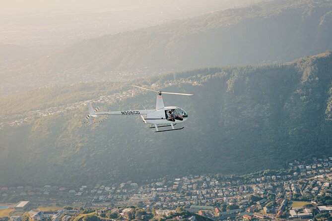
This tour includes aviation headsets. That’s a big deal. Helicopters are loud. The headset helps you hear your pilot’s comments, and it makes the whole experience feel more “guided” than just noise and window views.
It also includes a cell phone lanyard. If you’ve ever had to juggle a phone while moving, you know how quickly that becomes stressful. The lanyard is one of those small inclusions that removes a potential hassle.
Your pilot will show famous landmarks, valleys, waterfalls, and mountains as you fly. The exact set of sights called out depends on the flight and conditions, but the promise is consistent: you’re not just looking out the window. You’re getting help connecting what you see to what it is.
One review specifically praised a pilot named Stefan, describing the experience as professional and safe and giving a sense that the flight felt first class over Waikiki. That kind of pilot confidence matters because you’re trusting someone with both safety and storytelling at the same time.
Who should book this private helicopter tour
This is a good match if you:
- Want a big aerial view without a full day commitment
- Prefer private group time over joining a shared flight
- Like guided sightseeing where someone else helps you identify what you’re seeing
- Are traveling with people who’d enjoy “wow” moments more than museum time
It’s also worth it for honeymoon-style trips, anniversaries, and “we only have one splurge left” days. The ride is short, so it’s easy to build around the rest of your Oahu plan.
It may not be the best fit if you:
- Want lots of time on the ground at stops (this is a flight-only experience)
- Get nervous with heights or noise and want something slower
- Need a specific viewpoint for a long period of time
Weather, weight, and timing: how to plan so the day stays smooth
This experience requires good weather. That doesn’t just mean comfort. It means your flight could be rescheduled or refunded if conditions aren’t right for safe flying.
There’s also the 300 lbs total weight per passenger limit. If your group includes anyone near that cap, check early so you’re not dealing with last-minute disappointment.
On timing, the tour is listed as starting and ending at the meeting point, and the flight itself is about 30 minutes. Because weather can affect schedules, I’d treat the day like a “buffer day” where you’re not locked into a tight sequence of time-sensitive reservations.
Photo and video tips for a 30-minute flight (without stressing)
You’ll be in the air for only half an hour, so you want to use that time intentionally. I like to think in three modes: quick look, steady look, and capture.
- Quick look: take in the whole area as each landmark appears.
- Steady look: pick one or two spots you really want to frame, then hold steady.
- Capture: use your phone, but keep it secure using the provided cell phone lanyard.
Because you’ll be flying over multiple well-known areas—Waikiki, Diamond Head, harbors, and downtown—your best photos usually come from spotting the landmark first, then framing it as it moves across your window.
If you care about keeping video stable, keep expectations realistic. A helicopter ride is moving, and speed adds shake. The best approach is to shoot short clips rather than trying to record one long uninterrupted moment.
Should you book 30 Minutes PRIVATE Helicopter Tour in Honolulu?
If you want the most direct route to an aerial understanding of Honolulu, I’d say yes—especially with a private group. The flight is short but packed, the included headsets and phone lanyard remove common hassles, and the pilot guidance makes the views easier to appreciate.
I’d only hold off if weather is a big unknown for your dates or if your group includes someone who might hit the 300 lb weight limit. And if you’re expecting to roam, linger, and explore each landmark on foot, this won’t match that style.
Used well, this tour becomes the trip’s “orientation moment.” After it, you’ll look at Waikiki, Diamond Head, harbors, and road corridors back on the ground and suddenly everything makes more sense.
FAQ
How long is the helicopter tour?
The tour duration is about 30 minutes.
Is the 30 minutes the time in the air?
Yes. The listed flight time is 30 minutes.
How much does it cost?
The price is $359.00 per person.
Is this tour private?
Yes. It’s private, so only your group participates.
Where does the tour start and end?
The tour starts at 1 Lagoon Dr, Honolulu, HI 96819, USA, and ends back at the meeting point.
What’s included in the tour?
It includes a cell phone lanyard and aviation headsets.
Is there a weight limit?
Yes. Total weight per passenger is listed as 300 lbs.
Do I need good weather for this experience?
Yes. The tour requires good weather, and if it’s canceled due to poor weather, you’ll be offered a different date or a full refund.
When do I receive confirmation after booking?
Confirmation is received at time of booking.
Can I cancel for a refund?
Yes, free cancellation is available. You can cancel up to 24 hours in advance for a full refund, and changes less than 24 hours before the start time aren’t accepted.