REVIEW · OAHU
30 Minutes SHARED Helicopter Tour in Honolulu
Book on Viator →Operated by Honolulu Helicopter Tours · Bookable on Viator
Honolulu from above is a fast way to reset your Hawaii brain. In just 30 minutes, you’ll get an intimate look at Oahu’s coast and city grid from a small aircraft with pilot commentary. It’s not a long tour, so every minute is about seeing the island in one clean sweep.
I especially love the small-group feel: the max is three travelers, so you’re not packed in with strangers. I also like the practical add-ons like the aviation headsets and cell phone lanyard, which make it easier to hear the pilot and capture photos without fiddling.
One consideration: this is weather-dependent, and the schedule can shift if conditions aren’t right. If your trip is tight, build in a little flexibility so you don’t feel rushed.
In This Review
- Key things to know before you fly
- A 30-minute shared flight: what that small-group setup really buys you
- How the route fits into half an hour from HNL
- Stop-by-stop: what you’ll see from above (and what to expect)
- Start/finish: HNL and the quick transition to coastal views
- Sand Island
- Honolulu Harbor (Kulolia and Ke Awa O Kou)
- Ala Moana Beach Park and the long public shoreline
- Magic Island
- Ala Wai Harbor
- Waikiki and the coastline around Diamond Head
- Waialae Golf Course (edge-of-the-city green)
- Honolulu downtown and Iolani Palace area references
- A stop for Punchbowl Crater (National Memorial Cemetery of the Pacific)
- H201 Interchange and the view of highway geography
- Black Point Sea Pools
- Moanalua Gardens and the park setting
- H-3 (John A. Burns Freeway) and Tetsuo Harano Tunnels
- Aloha Stadium (Halawa)
- Photo and comfort tips that make the 30 minutes count
- Price and value: is $319 for 30 minutes a smart use of time?
- Planning for weather and a smooth day at HNL
- Should you book this shared helicopter tour?
- FAQ
- How long is the 30 Minutes shared helicopter tour?
- What is the group size limit for this tour?
- Where does the tour start and end?
- What’s included in the ticket price?
- What landmarks will I see during the flight?
- What language is the tour offered in?
- Is good weather required?
- What happens if the tour is canceled due to weather?
- What is the cancellation deadline for a full refund?
Key things to know before you fly
- Small-group tour (max three travelers) for calmer viewing and more attention from the pilot
- Pilot commentary helps you recognize what you’re seeing, not just where you’re looking
- 30 minutes covers a lot of Oahu, but it’s still quick—expect brief flyovers, not long stops
- Headsets included so you can hear guidance while staying comfortable in the aircraft
- Honolulu meeting point at 1 Lagoon Dr, near the airport area (easy to find once you’re there)
- Good weather required, so watch the forecast and keep a backup window open
A 30-minute shared flight: what that small-group setup really buys you

This is a “shared” tour, but it doesn’t feel crowded. With a maximum of three guests, you can actually look out and keep your gear sorted without bumping elbows or losing your view every time someone shifts. For many people, that’s the difference between a fun memory and a shaky, overstimulated one.
The pilot commentary matters more than you’d think on a short flight. When you know what you’re pointing at—like Diamond Head’s Hawaiian name or why a certain harbor sits where it does—you start seeing patterns instead of random landmarks. It turns the ride into a story you can follow.
You also get aviation headsets included. That’s a small detail that pays off fast: you can hear the pilot clearly and still talk with your group at a normal level inside the cabin. A cell phone lanyard is included too, which helps with the real-world problem of holding a phone steady while you’re looking at the view you came for.
You can also read our reviews of more tours and experiences in Oahu.
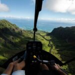
How the route fits into half an hour from HNL
The whole tour starts and ends at HNL (Honolulu). From there, the route is designed to string together the places people talk about—plus a few Oahu spots you usually only see from the road. Expect the helicopter to make quick passes overhead, so the “value” is the big-picture view more than lingering over any one spot.
Because the timeframe is tight, you’ll see a sequence of coastal and urban highlights along the south side of Oahu, plus inland/upslope features and major highway corridors. If you’re the type who likes to check off landmarks, you’ll appreciate how many names you can put to what you’re seeing.
If you want the best experience for your photos, plan to shoot in short bursts. In a 30-minute flight, you’ll be busy looking—and you’ll miss your best shot if you spend too long fiddling with settings.
Stop-by-stop: what you’ll see from above (and what to expect)

Below is what you’ll get a view of during the flight, grouped in a way that matches how you’ll experience it from the air.
Start/finish: HNL and the quick transition to coastal views
From HNL, the aircraft is set up for fast sightseeing. The advantage of starting near the airport zone is that you’ll reach the open-air coastline sooner, rather than spending your limited minutes on a long repositioning flight.
Sand Island
Sand Island is one of those places that looks like a simple strip from the ground, but from above it reads like a geographic anchor for the harbor side of Honolulu. You’ll see it as part of the wider port-and-waterfront system.
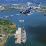




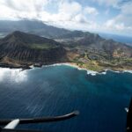
Honolulu Harbor (Kulolia and Ke Awa O Kou)
Honolulu Harbor is the principal seaport of Honolulu and Hawaiʻi’s main shipping gateway. From the helicopter, you’ll be able to connect the dots between water traffic, shoreline shape, and where the city wraps around the waterfront.
A drawback: harbors can be visually busy. If you try to photograph everything, the image can look cluttered. I recommend taking a step back mentally and capturing the harbor shape first, then zooming only when the view simplifies.
Ala Moana Beach Park and the long public shoreline
Ala Moana Beach Park is a 100-acre public park with a gold-sand beach that stretches for over half a mile. From above, you’ll get a clear sense of how Waikiki and downtown relate to each other—because this park sits between them.
This is also a good area for spotting the layout of beaches and nearby recreation space without walking or driving.
Magic Island
Magic Island is a man-made peninsula adjacent to Ala Moana Beach Park and the Ala Wai Yacht Harbor. From the air, it’s easier to see the artificial geometry—how it creates a protected, park-like edge.
If you’re expecting dramatic mountains here, keep your expectations grounded. The “wow” is the contrast between water, built features, and the straight lines of the coastline.
Ala Wai Harbor
Ala Wai Harbor is described as the largest small boat and yacht harbor in Hawaiʻi. From above, you can see the harbor mouth and how it sits between Waikiki and downtown-side waterfront.
It’s especially helpful if you’re the kind of person who has walked around the area but never really understood where all the water pathways lead.
Waikiki and the coastline around Diamond Head
Waikiki is the recognizable hotel-lined stretch along the surf beach. From the air, it’s easier to appreciate Waikiki not just as a neighborhood, but as a curved shoreline shaped by ocean access and nearby headlands.
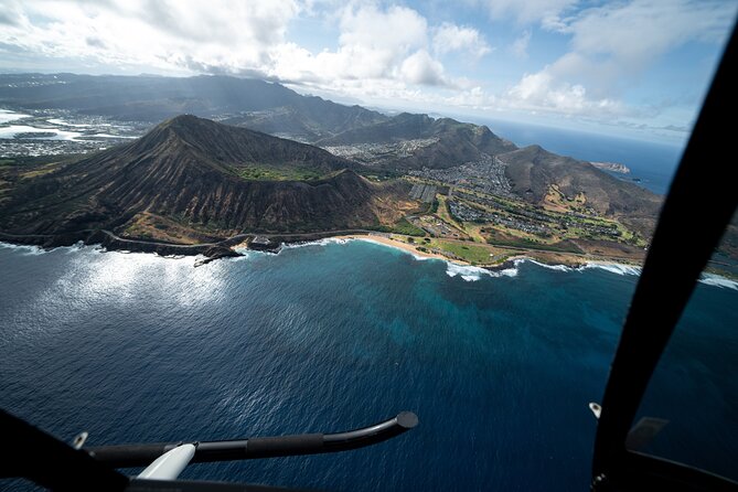
You’ll also see Diamond Head (Lēʻahi), a volcanic tuff cone. The Hawaiian name Lēʻahi is often linked to the ridgeline’s tuna-dorsal-fin shape. From above, that silhouette becomes obvious fast.
Photo note: Diamond Head is one of those landmarks where a slightly steadier shot makes the whole image. Take a breath, grab a few frames, then move on—because the ride keeps moving.
Waialae Golf Course (edge-of-the-city green)
Waialae Country Club is a private golf course in East Honolulu. From above, golf greens can look like patches of calm in a city of hard edges.
You may not be able to read individual holes from this height, but you’ll see the “green pocket” effect—why this part of the island feels calmer than the beachfront areas.
Honolulu downtown and Iolani Palace area references
Downtown Honolulu shows the business-and-government core, plus Iolani Palace and the Hawaii State Art Museum. From the air, you mainly get the skyscraper density and the city’s grid pattern, which helps you understand how the royal-site area fits into modern Honolulu.
This segment is useful if you want a mental map of where downtown sits relative to Waikiki and the harbor.
A stop for Punchbowl Crater (National Memorial Cemetery of the Pacific)
Punchbowl Crater is where the National Memorial Cemetery of the Pacific sits. From above, you’ll see how the crater shape and memorial site relate to the surrounding neighborhoods.
In a short tour, this is a grounding moment: it reminds you you’re not just looking at fun beaches and hotels—you’re flying over a place with major meaning.
H201 Interchange and the view of highway geography
The H201 interchange appears as part of the highway maze. From above, roads in Honolulu can look more logical than on the ground—especially when you can see how routes connect.
Drawback: if you’re hoping for classic scenic mountain viewpoints, this is the urban/engineering side of Oahu. It’s still interesting, just less “postcard.”
Black Point Sea Pools
Black Point Sea Pools are a shoreline area where ocean water shapes the coast. From the air, it can be harder to see the exact water patterns, but the black-rock-to-water contrast is often visible.
For photography, think of this stop as texture and color rather than detail.
Moanalua Gardens and the park setting
Moanalua Gardens is a 24-acre privately owned public park. It includes the Kamehameha V Cottage and is also known for features like the large monkeypod tree associated with the Hitachi tree connection.
From above, you’ll get the “island of greenery” feeling—how park space interrupts the urban corridor.
H-3 (John A. Burns Freeway) and Tetsuo Harano Tunnels
H-3 runs entirely within Oahu and crosses the Koʻolau Range along viaducts and through tunnels, including the long Tetsuo Harano Tunnels and smaller Hospital Rock Tunnels. From the air, you’ll see the freeway’s vertical climb and the way the terrain is handled.
This is one of the more technically interesting parts of the route—seeing how the island’s geography dictates engineering.
Aloha Stadium (Halawa)
Aloha Stadium is in Halawa, and from above it’s easier to spot as a landmark in a more spread-out area. This is the kind of stop that helps complete the map of Oahu beyond the shoreline.
Photo and comfort tips that make the 30 minutes count
You’ll likely want to shoot photos constantly. The trick is to shoot in small bursts and let the view lead the lens.
A tip from flight experience shared by others: people often recommend going doors off if your flight offers that option. It can make views feel more dramatic and photos feel less boxed-in. If it’s not available on your specific flight, don’t stress—the standard view can still deliver clear coastline and landmark shots.
Also: use the included headset so you can listen for pilot cues. When you hear the pilot talk about what’s coming next, you can time your photos instead of reacting after the aircraft has already passed.
One more real-world point: some teams provide photos taken during the flight and deliver them promptly. If that’s offered with your departure, it’s a nice backup—especially for those times when you’re busy looking out the window and not framing perfectly.
Price and value: is $319 for 30 minutes a smart use of time?
At $319 per person for roughly 30 minutes, this isn’t a budget activity. So I look at value in three ways: who it’s for, what you get that you can’t easily get otherwise, and whether the experience feels time-efficient.
Here’s what justifies the price for many people:
- You’re buying the bird’s-eye perspective of Honolulu, Waikiki, Diamond Head, the harbor system, and the highway-and-coast layout—all in one connected sweep.
- The small-group limit (max three) increases comfort and attention.
- The pilot adds context, which upgrades the tour from sightseeing to understanding.
It also helps that this kind of activity is typically hard to DIY. Yes, you can drive around Oahu. But you can’t easily recreate the relationship between Diamond Head, Ala Moana, Ala Wai Harbor, Waikiki, downtown, and Punchbowl in a single half-hour loop.
Who should consider booking:
- Couples and small families who want a bucket-list experience without a huge group
- First-timers who want a map-making overview before choosing day trips
- People who love photography and like having a professional pilot point out what to look for
Who might want to rethink:
- If you hate time pressure, because this is a quick flight with fast passes
- If your schedule is inflexible (weather can affect it)
- If you’re expecting lots of time on the ground—this is strictly aerial
Planning for weather and a smooth day at HNL
This tour requires good weather. That matters because helicopters are sensitive to visibility and conditions. If you schedule it as your only clear-plan activity, you risk losing the day if weather doesn’t cooperate.
One practical approach: pair this with a flexible activity the same week, not the same hour. If this gets rescheduled, you can still keep your trip moving.
You’ll meet at 1 Lagoon Dr, Honolulu, HI 96819, and the tour ends back at that meeting point. That round-trip simplicity is helpful: you aren’t dealing with a complicated pickup or a multi-location transfer.
Also note the stated weight limit: total weight per passenger is 300 lbs. If you’re close to that, check before you buy so there are no surprises later.
Should you book this shared helicopter tour?
If you want a high-impact Oahu overview in a short time, I’d book it. The small-group format, the pilot commentary, and the chance to see places like Waikiki, Diamond Head, Honolulu Harbor, and Punchbowl Crater from above make it feel worth the price for most people who can handle half an hour in the air.
Skip it only if your trip can’t absorb weather changes, or if you’re expecting a long, slow sightseeing experience. This is fast and focused. When it works, it’s a great way to look at Honolulu with fresh eyes.
FAQ
How long is the 30 Minutes shared helicopter tour?
The tour duration is approximately 30 minutes.
What is the group size limit for this tour?
This activity has a maximum of 3 travelers.
Where does the tour start and end?
The tour starts at 1 Lagoon Dr, Honolulu, HI 96819, USA, and ends back at the meeting point.
What’s included in the ticket price?
Included items are aviation headsets and a cell phone lanyard.
What landmarks will I see during the flight?
You’ll have a chance to see areas including Sand Island, Honolulu Harbor, Ala Moana Beach Park, Magic Island, Ala Wai Harbor, Waikiki, Diamond Head, Waialae Golf Course, Honolulu downtown, Punchbowl Crater, Moanalua Gardens, H-3, and Aloha Stadium.
What language is the tour offered in?
The tour is offered in English.
Is good weather required?
Yes. The experience requires good weather.
What happens if the tour is canceled due to weather?
If canceled due to poor weather, you’ll be offered a different date or a full refund.
What is the cancellation deadline for a full refund?
You can cancel up to 24 hours in advance for a full refund. Changes or cancellations within 24 hours are not refunded.