REVIEW · OAHU
60 Minutes SHARED Helicopter Tour in Honolulu
Book on Viator →Operated by Honolulu Helicopter Tours · Bookable on Viator
Honolulu looks totally different from above. This shared 60-minute helicopter tour gives you a fast, aerial sweep of Oahu’s most famous sights from HNL. You’ll spend the hour seeing beaches, harbors, and historic landmarks all at once—like Honolulu in one continuous view.
I really like two things about this style of tour: the pilots who keep the commentary practical and not overdone, and the sheer coverage you get for the money at $449 per person. You’re not stuck choosing between Waikiki, Pearl Harbor, or the North Shore—you get a broad sampling in one flight.
The one thing to keep in mind is that this is mostly about looking from the air. You should plan on a high-view, low-walk experience, not a chance to spend time inside every attraction named on the route.
In This Review
- Key things that make this Oahu helicopter tour worth considering
- Price and what you’re really buying (shared helicopter, 60 minutes)
- Meeting point and how to show up without stress
- What the 60-minute route actually feels like
- Stop 1: The Oahu sweep from HNL to the island’s biggest landmarks
- South shore and the Honolulu coast
- Diamond Head area and the volcanic edge
- Downtown and the darker side of Hawaii’s story
- Highways, interchanges, and how the island moves
- Stadiums and golf courses
- The Pearl Harbor and naval section
- Hanauma Bay and “wow” nature shapes
- Makapuu, tide pools, and lighthouse views
- Laie, the Mormon Temple area, and north-side coastlines
- Dole Plantation and the inland-agriculture picture
- Final return toward Honolulu
- Stop 2: Waikiki from above (more than just tall buildings)
- A quick practical tip
- Stop 3: Diamond Head crater views that feel instant
- Stop 4: Hanauma Bay Nature Preserve from the air
- Stop 5: Makapu’u Point tide pools and the lighthouse area
- Stop 6: Dole Plantation and the inland patterns
- Stop 7: USS Arizona Memorial and the Pearl Harbor story from overhead
- Pilot style and safety: what to expect once you’re in the air
- Weather, timing, and how to choose the right day
- Who this tour is best for (and who might skip it)
- Should you book the 60-minute shared helicopter tour of Honolulu?
- FAQ
- How long is the 60 Minutes shared helicopter tour?
- Where does the tour start and end?
- What does the tour cost?
- Is the tour offered in English?
- How many people are on the tour?
- What landmarks can you see during the flight?
- Do you need good weather to fly?
- What is the cancellation window?
Key things that make this Oahu helicopter tour worth considering

- Shared flight with a small cap: up to 3 travelers, which usually feels less crowded than big group tours.
- A huge “checklist” of sights: Waikiki, Diamond Head, Hanauma Bay, Makapuu, Dole, and Pearl Harbor areas all make the route.
- Pilot narration that works: pilots like Stefan and Jim are known for just enough guidance so you can still take it in.
- Good weather matters: this tour needs solid conditions, so your date choice affects your odds.
- Weight limit is clear: total passenger weight is listed at 300 lbs.
Price and what you’re really buying (shared helicopter, 60 minutes)
At $449 per person for about an hour, you’re paying for time in the sky—not for hotel pickup, long stops, or a slow sightseeing day. For many visitors, that’s the value: Oahu looks big from the ground, but from the air the island’s shapes make sense fast.
Because it’s shared, you’re not paying for a private cockpit. And with a max of 3 travelers, the vibe tends to feel calmer than large-vehicle group tours. If you’re traveling as a couple or a pair of friends, it can also work out well compared with private helicopter pricing—while still giving you the big, dramatic aerial payoff you came for.
One more money point: you’re paying for a specific kind of sightseeing. This isn’t about learning a single neighborhood on foot. It’s about seeing the whole island’s famous geography—coastlines, bays, harbors, and viewpoints—in one concentrated block.
You can also read our reviews of more tours and experiences in Oahu.
Meeting point and how to show up without stress

You start and end at 1 Lagoon Dr, Honolulu, HI 96819 (back to the same meeting point). The meeting spot is listed as near public transportation, which helps if you don’t want to rely on a taxi for this short leg.
The tour uses a mobile ticket, and you’ll also get a cell phone lanyard. That’s a small detail, but it’s the kind that keeps your phone secure while you’re looking up and around—especially if you’re trying to capture quick skyline moments before takeoff.
My practical advice: arrive early enough to park or shuttle without rushing. Helicopter time is tight. If you’re late, you can miss your flight window, and that’s not a fun surprise after you’ve planned your day.
What the 60-minute route actually feels like

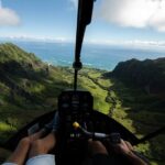
This flight is described as a shared tour with a major sweep of Oahu. The route covers the south and west coastal side first (think harbors and resort belt), then swings out toward iconic viewpoints and shoreline areas, and wraps back toward Pearl Harbor’s historic zone and central Honolulu.
Even though the tour lists many named places, the experience is really about aerial “clusters.” You’ll recognize a place, clock it visually fast, then move on to the next—like flipping through a photo album where each page is a new angle of the island.
And that’s why the full 60 minutes matters. A shorter flight might feel like a highlight reel; sixty minutes is long enough to start understanding how everything connects—how Waikiki’s coastline sits next to Honolulu’s harbors, where the big headlands rise, and how Pearl Harbor’s protected waters fit into the shoreline.
Stop 1: The Oahu sweep from HNL to the island’s biggest landmarks

Your first big chunk is the overall Oahu circuit, starting and ending at HNL. The route includes an impressive mix of city views, coves, and historic sites—so even if you can’t identify every name in the air immediately, you’ll quickly recognize the shapes.
South shore and the Honolulu coast
You’ll have a chance to see places like Sand Island, Honolulu Harbor, Ala Moana Beach Park, Magic Island, Ala Wai Harbor, and Waikiki. From above, Waikiki stops looking like just a beach strip and starts looking like a carefully shaped shoreline—plus you can spot where the in-town oceanfront meets harbor structures.
This part is often what people love most because it gives you the “where am I?” clarity. After that, Diamond Head and the resort towers feel less random because you understand their positions relative to the ocean and harbors.



Diamond Head area and the volcanic edge
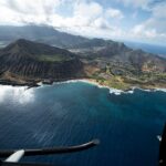
Diamond Head appears on the route later, but it already sets the stage here. When you’re flying toward it, you’ll see how the crater-shaped headland turns the skyline into a natural landmark. It’s one of those views that’s hard to replicate from the ground, because the angle from the air shows the whole scale.
Downtown and the darker side of Hawaii’s story
The route includes Honolulu Downtown and Punchbowl Cemetery. Those are emotional places, and seeing them from above can feel surprisingly respectful—like the island is showing you both the glitz and the gravity in one sweep.
Highways, interchanges, and how the island moves
You’ll also see parts of the infrastructure that visitors rarely connect to sightseeing. Names like H201 Interchange, H3 Highway, and Aloha Stadium show up in the route. From the air, those roads become patterns. You get a sense of how Oahu concentrates movement around a few corridors.
It’s not everyone’s favorite part, but it’s useful. It helps you understand why traffic can feel intense on certain drives—and it makes your own rental car routes feel less confusing later.
Stadiums and golf courses
Aloha Stadium, Ala Wai Golf Course, and Waialae Golf Course are on the list. From above, these places read as big, well-defined islands of green. They’re also good reference points for orientation: you’ll start picking out “this is the golf course zone” faster than you think.
The Pearl Harbor and naval section
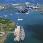
One of the big reasons to choose a flight like this is the chance to see the Pearl Harbor complex from overhead. Your route includes Pearl Harbor Memorial, the USS Missouri (described as USS Missouri-Mighty Mo warship), a retired navy ship fleet, the USS Arizona Memorial, and the USS Utah.
Seeing these from the air can be sobering. The water makes the memorials look even more defined, and you can take in the layout in seconds without fighting crowds or time limits on the ground. Even if you plan to visit one memorial later, this aerial view gives you a head-start for what you’ll be looking at.
Hanauma Bay and “wow” nature shapes
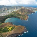
The route also includes Hanauma Bay Nature Preserve, plus a famous blow hole and areas labeled Sandy’s beach and Rabbit Island. From the air, Hanauma’s coastline and protected water can look like a natural bowl. The blowhole and rocky shore lines are also easier to understand from above because you can see the geology that causes the action below.
Important note: this tour is weather-dependent. If your day is too rough, you may get rebooked rather than flying. So build flexibility if you can.
Makapuu, tide pools, and lighthouse views
Later, you’ll spot Makapuu point, Makapuu Light House, and the route includes Pele’s chair. That area’s cliffs are dramatic from above. Even from a helicopter window, you can usually see the cliff edge clearly, which helps you understand why the viewpoint reputation is so strong.
Laie, the Mormon Temple area, and north-side coastlines
The route mentions Laie Arch / Mormon Temple, then moves toward Turtle Bay and Sunset Beach. It also lists Bonsai Pipeline and Waimea Bay, plus Haleiwa Town and Oahu Central Valley.
From the air, the North Shore coastline can look like repeating patterns—headlands, breaks, and beaches lined up along a long stretch. Haleiwa, in particular, often stands out as a recognizable town pattern against the coastline. If you’re the type who likes mapping your day, this is where you start doing it fast.
Dole Plantation and the inland-agriculture picture
This flight includes Dole Pineapple Plantation and Dole Maze. From above, plantations make sense as land-use blocks rather than just a stop you drive to. You see how agriculture sits among other inland areas, which is hard to notice on the road.
Even if you don’t plan to do the plantation portion on a separate day, this aerial view helps you picture what you’re walking through later.
Final return toward Honolulu
As the route circles back, it includes places named Federal Penitentiary, Tripler’s pink Hospital, and the naval and downtown area again. That mix gives you a sense that the flight isn’t only about beaches. It’s about Oahu as a full working island—city, history, and coastline all in the same hour.
Stop 2: Waikiki from above (more than just tall buildings)
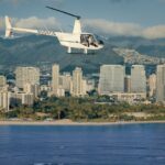
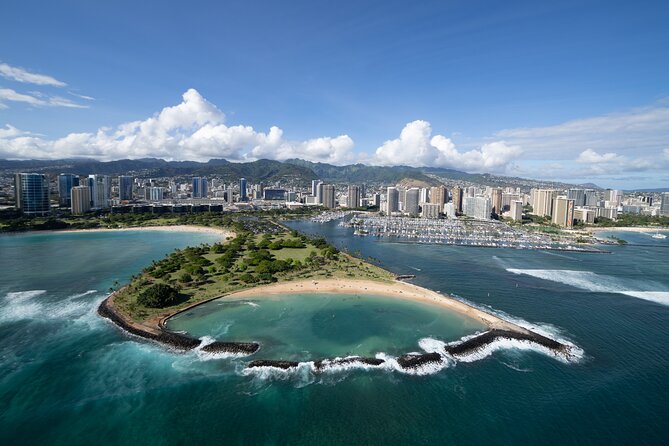
Waikiki is listed as a dedicated stop, and that makes sense. From the air, Waikiki turns into a coastline blueprint: the beach curve, the hotel strip, and the in-water structures near the harbors.
If you’ve only seen Waikiki from street level, a helicopter viewpoint adds scale. It’s easier to understand what portions of the beach are sheltered versus exposed. It also makes the contrast clearer between Waikiki’s busy resort zone and the calmer water areas around nearby harbors.
A quick practical tip
Look for Ala Wai Harbor and the nearby shoreline lines. They help you orient quickly even if you’re overwhelmed by how much you see from the air.
Stop 3: Diamond Head crater views that feel instant

Diamond Head is on the route with a specific stop label. From overhead, it’s the kind of feature that reads immediately: a crater-shaped form with clear edges. You can often see how it guides the skyline and breaks up the coastline.
This is also one of the places that helps first-time visitors understand Oahu’s geography. Once you’ve seen it from above, ground-level photos look different afterward—because you start remembering where the headland is relative to Waikiki and Honolulu.
Stop 4: Hanauma Bay Nature Preserve from the air
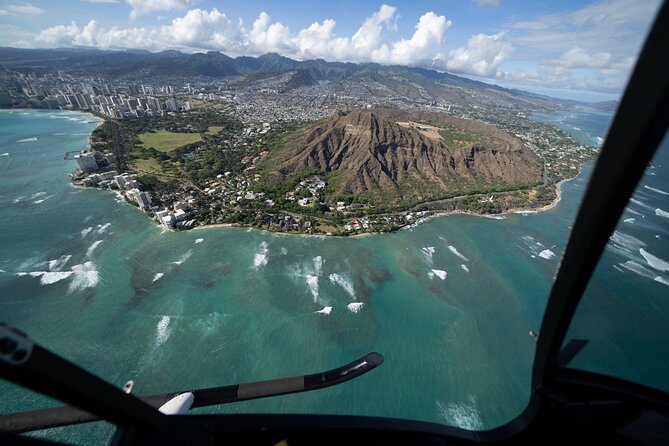
Hanauma Bay is listed as a stop. Even without going on a hike or spending time on the ground, you’ll likely notice the protected, curving water. From the sky, it looks less like a single “pretty bay” and more like a natural amphitheater.
This is a great stop if you’re planning a beach-focused itinerary too. The helicopter view can help you choose what kind of shoreline you want later—calm-looking water versus more open surf zones.
Stop 5: Makapu’u Point tide pools and the lighthouse area
Makapuu Point appears along with a lighthouse, and it’s on the route for a reason. Headlands like this are dramatic from above, because you can see the cliff lines and the way the coastline bends.
The route also notes tide pools, which makes this segment more interesting for people who love geology. From the air you may not pick out every pool detail, but you can see where the coastline creates the right conditions for them.
Stop 6: Dole Plantation and the inland patterns
Dole Plantation is included as a stop. From above, you’ll see plantation blocks and the bigger agricultural layout—so it’s not just a brand name on the map. The route also references Dole Maze, which makes the whole stop feel more like a place with a designed layout rather than random fields.
If you’re deciding whether to add the plantation to your day, this aerial view helps you gauge the area and decide if it’s worth your time.
Stop 7: USS Arizona Memorial and the Pearl Harbor story from overhead
The route calls out the USS Arizona Memorial as its own stop, and that’s the emotional anchor for a lot of visitors. From the air, the water and the memorial structures create a clear, organized scene. It’s the kind of view that makes the location feel real quickly, especially if you’re visiting for the first time.
Even if you plan to spend time on the ground later, this helicopter perspective can help you understand what’s where, so you’re not starting from zero when you arrive.
Pilot style and safety: what to expect once you’re in the air
Safety is clearly treated as part of the experience, not an afterthought. In one case, a communication issue led to a quick return for a headset change, and the tour still made sure you got the full sixty minutes of flight time.
That tells you something important: the goal is to keep the experience controlled and comfortable, even when there’s a minor technical hiccup. You’ll also benefit from choosing a day with better flying conditions, because rough weather can affect what happens.
For the narration, the pilots named in feedback—like Stefan and Jim—are described as informative without taking over the cockpit. That’s the ideal approach. You want enough context to connect what you’re seeing to names like Makapuu or Pearl Harbor, but you still need room for your own wow moments.
Weather, timing, and how to choose the right day
This tour requires good weather. If it’s canceled due to poor conditions, you’ll be offered a different date or a full refund. That’s not just fine print—it’s central to planning.
If your trip has limited flexibility, this is the type of activity where having a backup day matters. Oahu can change fast. If you’re flexible, schedule the helicopter on a day where you’d be okay shifting other plans.
As for timing, the tour is about 1 hour total. Booking on the times you prefer is key, because you’re paying for a specific flight window and shared schedules.
And yes, this type of tour tends to book ahead. It’s averaged around 29 days in advance, so if this is on your must-do list, plan earlier rather than later.
Who this tour is best for (and who might skip it)
This helicopter tour is best for you if:
- You want to see a lot of Oahu in one sitting without driving all day.
- You like aerial orientation—seeing where things sit relative to each other.
- You’re doing a short trip and want a high-impact experience early.
Consider skipping (or swapping to something else) if:
- You’re looking for long on-the-ground time at one site.
- You hate the idea that weather can change plans.
- You want a deeper, slower tour of just one neighborhood or memorial area.
Should you book the 60-minute shared helicopter tour of Honolulu?
Yes, if you want one hour that gives you the island’s big visual story. This is the kind of experience that helps your whole Oahu trip click—Waikiki feels less generic, Pearl Harbor has clearer context, and the North Shore coastlines start making sense without you needing a full day behind the wheel.
Book it if you can work around weather and you’re comfortable with a from-the-air format. Skip it if you need lots of time on the ground at specific attractions or if your schedule is too rigid to handle rescheduling.
Bottom line: for the price, you’re buying time in the sky—and in Honolulu, that’s often the most efficient, most memorable way to see Oahu.
FAQ
How long is the 60 Minutes shared helicopter tour?
It’s approximately 1 hour.
Where does the tour start and end?
The tour starts and ends at 1 Lagoon Dr, Honolulu, HI 96819, USA.
What does the tour cost?
The price is $449.00 per person.
Is the tour offered in English?
Yes, the tour is offered in English.
How many people are on the tour?
This activity has a maximum of 3 travelers.
What landmarks can you see during the flight?
You may see places such as Sand Island, Honolulu Harbor, Ala Moana Beach Park, Magic Island, Waikiki, Diamond Head, Hanauma Bay, Makapu’u Point, Dole Plantation, and USS Arizona Memorial, along with many other named areas on the route.
Do you need good weather to fly?
Yes. The experience requires good weather. If it’s canceled due to poor weather, you’ll be offered a different date or a full refund.
What is the cancellation window?
You can cancel up to 24 hours in advance for a full refund. Changes within 24 hours of the start time aren’t accepted, and the amount paid won’t be refunded for cancellations later than that.