REVIEW · MAUI
Waterfalls of West Maui and Molokai Helicopter Tour
Book on Viator →Operated by Blue Hawaiian Helicopters - Maui · Bookable on Viator
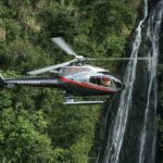
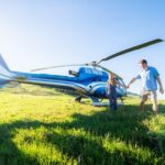
Want Maui and Molokai from the sky? This small-group helicopter tour turns the West Side’s valleys into something you can actually read from above, thanks to Bose aviation-grade headsets and a pilot who’s also a Hawaii state-certified tour guide. My one caution: weather and wind can shape how close you get to waterfall moments, so go in expecting great aerial valleys more than a guaranteed waterfall-by-waterfall checklist.
This is a fast hit—about 50 minutes—and the max 6 travelers setup keeps the vibe calmer than a cattle-car tour. You’ll hear pilot commentary through noise-cancelling gear, then get an after-tour video preview at the heliport. It’s pricier than a boat, but you’re paying for angles you can’t get any other way.
In This Review
- Key things to know before you fly
- Why this West Maui to Molokai helicopter tour feels worth the money
- Inside the cabin: Bose headsets, 2-way comms, and real comfort
- The flight plan: your aerial tour stop-by-stop
- Maui’s shoreline and Haleakala-West Maui views
- The gateway toward ‘Iao Valley and West Maui Mountains
- Waihe’e: lush ridgelines from above
- Kahakuloa Bay and the long West Maui Mountain Road
- Mauna Kahālāwai: the highest peak of the West Maui Mountains
- Fly-bys en route to Molokai and back
- Molokai: world-famous sea cliffs and Kalaupapa
- Kapalua: beaches, crystal water, and the golf course geometry
- Pelekunu Bay and Pelekunu Valley: the water story
- Molokai’s cliff and Kalaupapa area: why this part lands hardest
- West Maui’s best aerial hits: Waihe’e, Kahakuloa, and the ridge logic
- Photo and video realities: what to plan for before you go
- Price breakdown: what’s included, what’s not, and how to think about value
- Timing and check-in: make it easy on yourself
- Safety, weight rules, and who the tour suits best
- Should you book this West Maui and Molokai helicopter tour?
- FAQ
- How long is the Waterfalls of West Maui and Molokai helicopter tour?
- What’s included in the price?
- What should I budget for if I want photos or video?
- When do I need to check in, and can I arrive late?
- Is there a weight limit for passengers?
- What happens if weather affects the flight?
Key things to know before you fly
- Bose Aviation-grade headsets: noise-cancelling and built for helicopter sound, with clear narration
- Pilot-guides with state certification: you’re not just getting sightseeing, you’re getting guided interpretation
- West Maui + Molokai in one flight: see ridges, bays, sea cliffs, and the Kalaupapa area from above
- Small group (max 6): easier to ask questions and feel more personal during the briefing and flight
- Wear dark clothing: bright fabric can reflect in photos from the cabin
- Optional photo/video packages: you can buy add-ons with a credit card after the tour
Why this West Maui to Molokai helicopter tour feels worth the money
At $460.90 per person for about 50 minutes, this isn’t a “cheap thrills” outing. The value comes from what’s included: guided narration through aviation-grade headsets, plus two-way microphone communication with the pilot. That combo matters, because it turns the flight from passive sightseeing into an actual guided experience.
This route also hits two different personalities of Hawaii in one go. West Maui brings ridgelines, bays, and those dramatic mountain-road views, while Molokai adds the big-sky, big-cliff feeling—especially around the Kalaupapa community and the Pelekunu area. If you only have a short window on Maui and you want more than one island’s “wow,” the helicopter makes sense.
The other reason I think it’s good value: the company keeps group size capped at 6 travelers. In practice, that usually means less crowd noise and more chances for your pilot to tailor commentary to what the cabin can see.
You can also read our reviews of more tours and experiences in Maui.

Inside the cabin: Bose headsets, 2-way comms, and real comfort
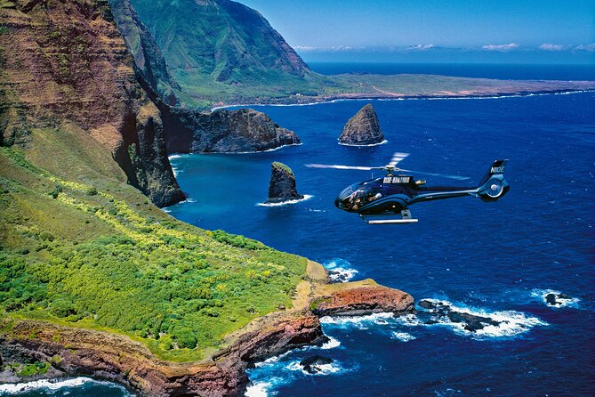
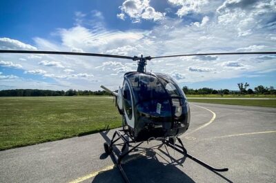
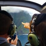
The included Bose Aviation-grade electronic noise-cancelling headsets are a big deal. Helicopter sound can be intense, and with this setup, you can follow the story the pilot is telling instead of just guessing what you’re looking at.
You also get microphones with 2-way communication. That’s not just a nice-to-have. It helps if you need a quick question answered mid-flight, or if you’re trying to pin down a place name you keep hearing.
A few practical details I’d plan around:
- Check-in is 45 minutes early: this is for weight check-in, safety briefing, and getting seated so the flight leaves on time. Late arrivals may not be accepted.
- Wear dark clothing: bright colors can reflect in photos taken from the aircraft.
- Skip scuba for 24 hours: if you’ve been diving, you’ll want to wait a day.
- Bring a credit card: optional video/photo packages and souvenirs are available for purchase at the heliport.
The flight plan: your aerial tour stop-by-stop
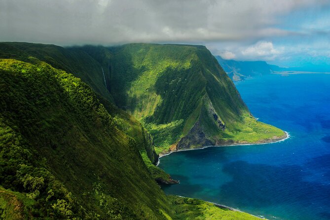
The flight is built around West Maui’s ridge-and-bay geometry and then pushes out to Molokai’s cliffs. You’ll be looking down at ocean edges, valleys, and mountain contours that are hard to appreciate from the ground—even from the best overlooks.
Maui’s shoreline and Haleakala-West Maui views
Early on, you’ll skim over the part of Maui that feels like the beating heart of the island: shoreline views paired with sightlines toward Haleakala and the West Maui Mountains. From the air, the coast reads like a map—long curves of shoreline, changing colors of water, and the way the mountains rise quickly once you get inland.
What to watch for: the coastline shape and where roads cut into the slopes. Helicopter altitude makes those lines obvious.
The gateway toward ‘Iao Valley and West Maui Mountains
Next, you fly over an older population center area that acts like a gateway toward ‘Iao Valley and the West Maui Mountains. This is the moment where the flight starts to feel more “interpretive.” Instead of only seeing pretty views, you’ll start connecting the geography to how people used to move, live, and travel through these areas.
Practical tip: if you’re trying to photograph, keep your shots slower here. Let the pilot point, then shoot.

Waihe’e: lush ridgelines from above
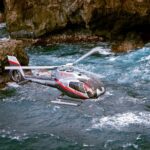
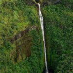
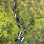
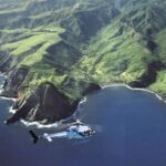
Then comes Waihe’e, known from above for lush ridge lines that create bold, dramatic angles. This is the kind of terrain that makes helicopter flying feel like a cheat code. From ground level, ridges can look flat. From the air, they show depth fast.
What you’ll likely enjoy most: the way the vegetation patterns break up the slope textures. It’s not just green—it’s a patchwork of shape and shade.
Kahakuloa Bay and the long West Maui Mountain Road
You’ll pass over Kahakuloa Bay, described as one of Hawaii’s more remote former fishing village areas along the winding West Maui Mountain Road. The helicopter perspective makes the word remote feel real. The bay looks tucked away, and the road’s curves help you understand how far removed it is from the main tourist corridors.
Photo tip: if you like wide shots, this is a good place to grab them. The cabin gives you room to include the bay plus the road lines that lead to it.
Mauna Kahālāwai: the highest peak of the West Maui Mountains
Next is Mauna Kahālāwai, the highest peak mentioned in the route notes. From the air, peaks like this don’t just look tall—you see how they anchor the entire ridge system. It’s one of those moments where the whole West Maui “shape” clicks into place.
If you’re someone who likes geology and terrain logic, don’t rush. Watch how the mountain mass connects to valleys you’ll see later.
Fly-bys en route to Molokai and back
There are also a couple of fly-by segments where you’ll likely get rapid orientation: brief looks at other valley angles and coastline patterns as the aircraft transitions across the water. Think of these as the “glance-and-learn” parts—great if you’re paying attention to scale.
Molokai: world-famous sea cliffs and Kalaupapa
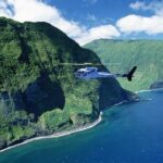
When you reach Molokai, the vibe changes immediately. You’ll fly by the world’s highest sea cliffs and the Kalaupapa community. This is Hawaii viewed at extreme scale: cliff walls dropping to the ocean, headlands that look almost vertical, and the way communities sit into the edges of the island.
What makes it powerful from a helicopter: you don’t need a long hike to understand why this place has such a strong identity. The air view gives you instant context.
Kapalua: beaches, crystal water, and the golf course geometry
You’ll also fly past Kapalua. Here the scenery shifts again to beaches and crystal-clear water, plus the neatly designed lines of golf courses. From above, Kapalua has a clean, planned feel—especially compared with the wild valleys and cliff faces elsewhere on the route.
If you love contrast, this part helps. You’ll see both the engineered and the wild, side by side.
Pelekunu Bay and Pelekunu Valley: the water story
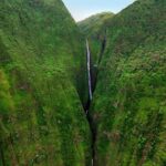
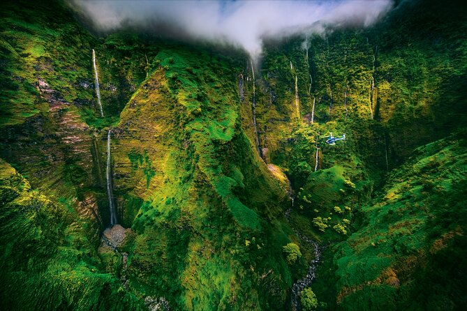
Finally, you’ll fly by Pelekunu Bay, the entrance to Pelekunu Valley, where one of the last remaining free-flowing streams is noted, along with preserved ancient Hawaiian fauna. Even if you don’t see a big dramatic fall every second, you’ll get the “water in the valley” idea—where it comes from, where it gathers, and how it shapes the land.
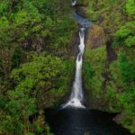
What to expect: this tour is set up to show valleys and waterways from above. If you’re expecting multiple close-up waterfall hover moments, keep expectations flexible.
Molokai’s cliff and Kalaupapa area: why this part lands hardest
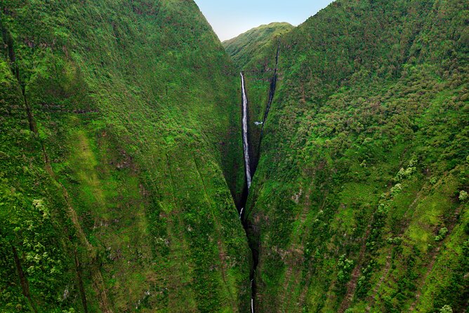
Molokai is the emotional weight of this route. West Maui gives you variety, but Molokai brings scale and severity. Flying near massive sea cliffs is one of those experiences that makes your brain re-check distances. The ocean looks thin in some places and impossibly deep in others.
The Kalaupapa area adds a human anchor to all that geography. Even from the air, you can see how a community can exist in a place defined by access, cliffs, and isolation. It’s not just pretty—it’s perspective.
West Maui’s best aerial hits: Waihe’e, Kahakuloa, and the ridge logic
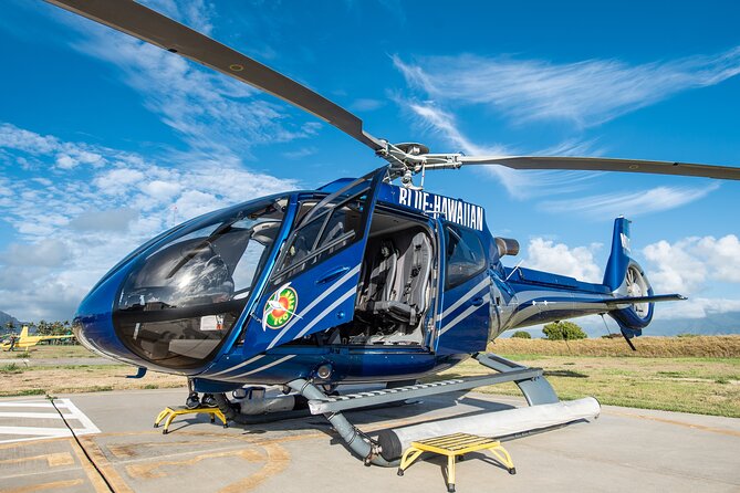
This route’s West Maui stretch is built for people who like “how the island works.” Waihe’e gives you ridges and texture. Kahakuloa Bay gives you remoteness and a feeling for how geography shapes settlement. Mauna Kahālāwai gives you the peak anchor so the rest of the terrain makes sense.
If you’ve driven the roads before, you’ll probably appreciate this part even more. The helicopter turns those winding routes into an aerial diagram. That’s when the photos stop being just snapshots and start becoming travel memory.
Photo and video realities: what to plan for before you go
You’ll be in the air for about 50 minutes, so you don’t want to spend half the flight messing with settings. Dark clothing helps photos because it reduces glare from inside the cabin.
Optional photo/video packages are available after the flight, and you’ll want a credit card ready if you decide to buy. The tour includes an after-tour video preview at the heliport, which is helpful if you’re deciding whether the add-ons are worth it for your group.
One more practical note: if you’re bringing a camera or phone, keep it secure. Motion happens, even if the ride feels smooth.
Price breakdown: what’s included, what’s not, and how to think about value
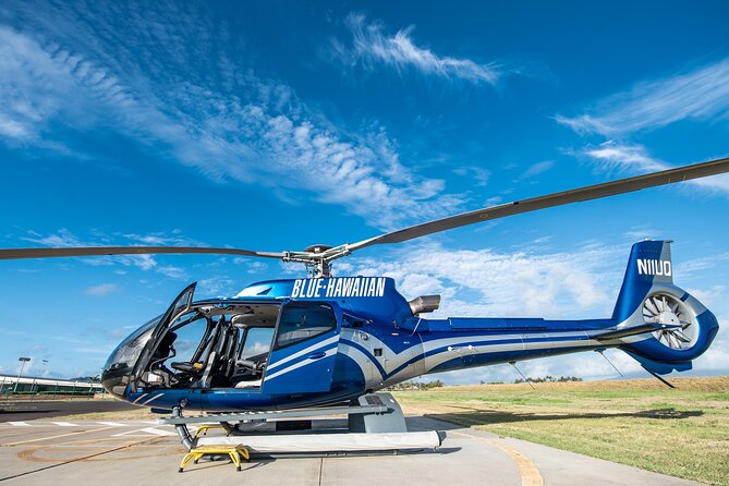
Here’s how I’d frame the cost. You’re paying for:
- A small-group helicopter flight (max 6)
- Bose aviation-grade headsets
- Two-way communication with your pilot
- A pilot who’s also a Hawaii state-certified tour guide
- An after-tour video preview
- All fees and taxes included in the listed price
What’s extra:
- Optional USB photo/video packages for purchase
- Transportation to and from the heliport
- Parking fees at the heliport
- Gratuity, which isn’t included and is left to your discretion
My rule of thumb: this tour makes the most sense if you’re comparing it to other “see it fast” options. If you want a close-in aerial view of waterfalls/valleys and don’t want to spend hours driving to lookouts, it’s a good use of money. If you’re trying to maximize minutes per dollar, you’ll likely feel the cost.
Timing and check-in: make it easy on yourself
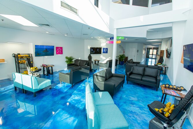
Check-in is 45 minutes before departure. This isn’t busywork—it’s for weight check-in, safety briefing, and getting you seated quickly. Traffic can happen, and late arrivals may not be accepted, so I’d plan buffer time.
You’re also told to bring your mobile ticket, and the tour is offered in English. The meeting point is at Blue Hawaiian Helicopters, Lelepio Pl #1, Kahului. Your tour ends back at the same place.
Safety, weight rules, and who the tour suits best
Helicopters are strict about weight, and this one is too. The stated limit is 240 lbs per passenger. If you weigh over that, the aircraft needs balance, so an adjacent empty seat is required. That second seat is half off the regular tour price, and it needs to be arranged after booking.
This tour is also described as something most travelers can participate. Still, it’s smart to take the rules seriously—headsets, safety briefing, and weight checks exist to keep the flight smooth.
This is a strong pick for:
- Couples on a special occasion who want one big, memorable view
- Families who want to skip long travel time and still see Maui and Molokai from above
- First-time helicopter riders who want a guide-led experience with two-way communication
It’s not the best fit if you want lots of time on the ground or a slow, walking-heavy day.
Should you book this West Maui and Molokai helicopter tour?
If you want a single outing that gives you West Maui valleys, remote bays, and then Molokai’s cliff-and-community scale, this is a very efficient way to do it. The included Bose aviation headsets and the pilot who’s also a state-certified tour guide are the real reasons I’d say yes. You’ll spend your money on views and context—not just a flight.
I’d only hesitate if your main goal is a long checklist of close-up waterfalls in multiple deep-valley passes. The flight is weather-dependent, and the route is built around valleys and water features more than a guaranteed waterfall-by-waterfall spectacle.
If you’re flexible on that, and you want that “island from above” perspective quickly, book it.
FAQ
How long is the Waterfalls of West Maui and Molokai helicopter tour?
The tour runs about 50 minutes.
What’s included in the price?
You get Bose aviation-grade electronic noise-cancelling headsets, microphones with 2-way communication with the pilot, a pilot who is also a State of Hawaii certified tour guide, an after-tour video preview at the heliport, and all fees and taxes.
What should I budget for if I want photos or video?
There are optional USB in-flight video and photo packages available after the flight for purchase, and you should bring a credit card for those add-ons.
When do I need to check in, and can I arrive late?
Check-in is 45 minutes prior to tour time for weight check-in, safety briefing, and seating. Late arrivals may not be accepted and are non-refundable, so plan extra travel time.
Is there a weight limit for passengers?
Yes. The total weight per passenger limit is 240 lbs. If you’re over 240 lbs, an adjacent empty seat is required to balance the aircraft, and the second seat charge is half off; you arrange that after booking.
What happens if weather affects the flight?
This tour requires good weather. If it’s canceled due to poor weather, you’ll be offered a different date or a full refund. If you cancel yourself, free cancellation is available up to 24 hours in advance for a full refund.